Dyrholaey
We explored Vik and its surrounding attractions on our first morning from “The Barn” (our stay in Vik) after a great night rest. Our first destination was Dryholaey which was a 17 minutes drive from our stay.

Dyrholaey was a promotory about 120 metres tall. There were two carparks at Dyrholaey. From road 218 we turned right going upslope reaching one of two carparks. Parking was free. From the carpark was a short walk to Dyrholaey Lighthouse. The “light” was housed in a red cylindrical “tank” on top of a “castle like” square tower with two lower house structures, one on each side. This lighthouse was installed in 1910 and rebuilt in 1927, it marked the southernmost point of the mainland of Iceland.
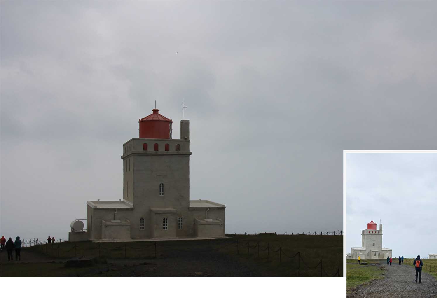
From the lighthouse we followed the walking path bringing us nearer to the edge of the cliff and there we saw a jutting cape with two arches. Now we understood the reason this location was named Dyrholaey viewpoint on the google map as this place was where we could have a great view of Dyrholaey Arch.
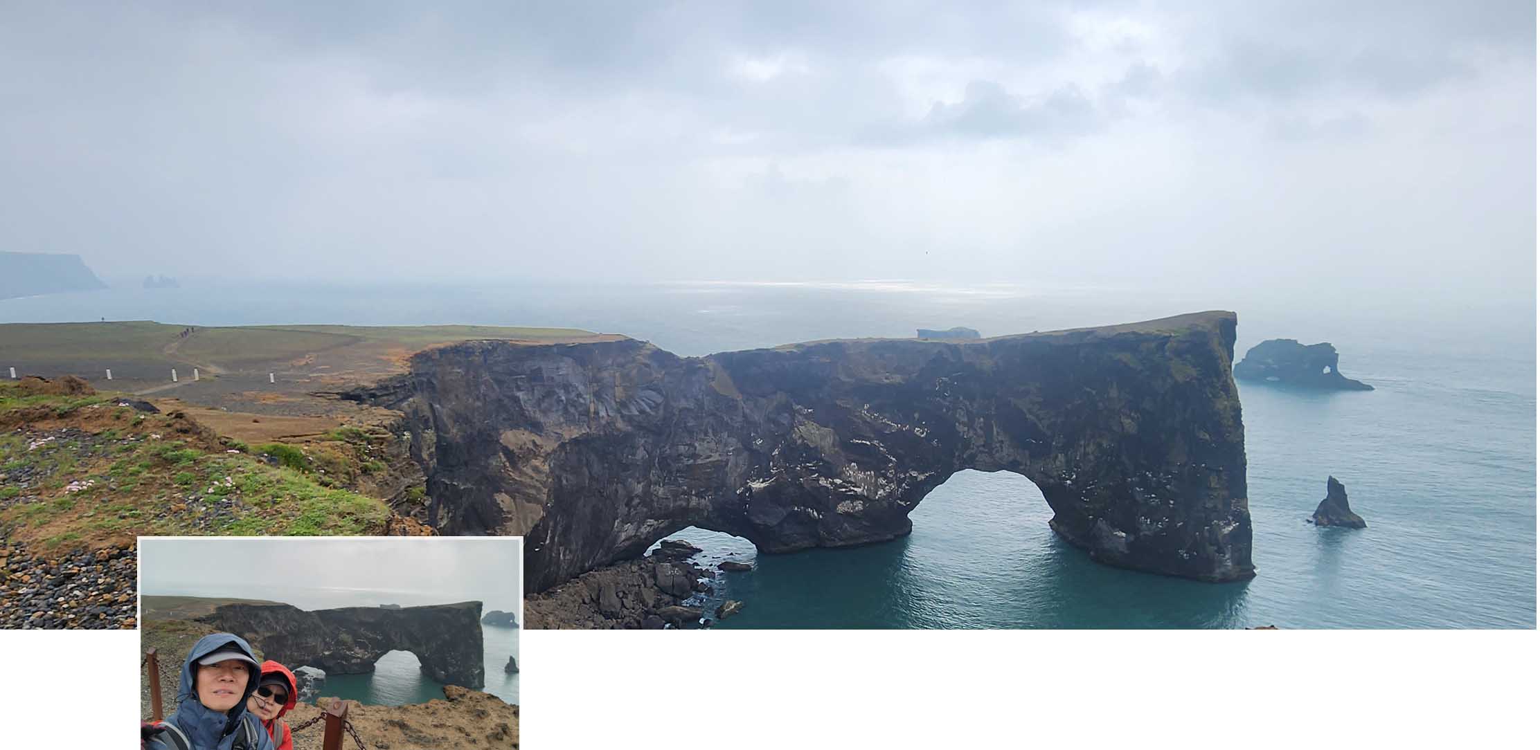
The Arch
From Dyrholaey Viewpoint we saw several walking paths leading to the lower slope of Dyrholaey. Rather than walk we drove down to the second carpark which was on the lower slope, there we parked our car (free parking) before coming out to explore the lower slope of Dyrholaey. From the lower slope we could see had a wonderful view Reynisfjara which was further east of Dyrholaey.

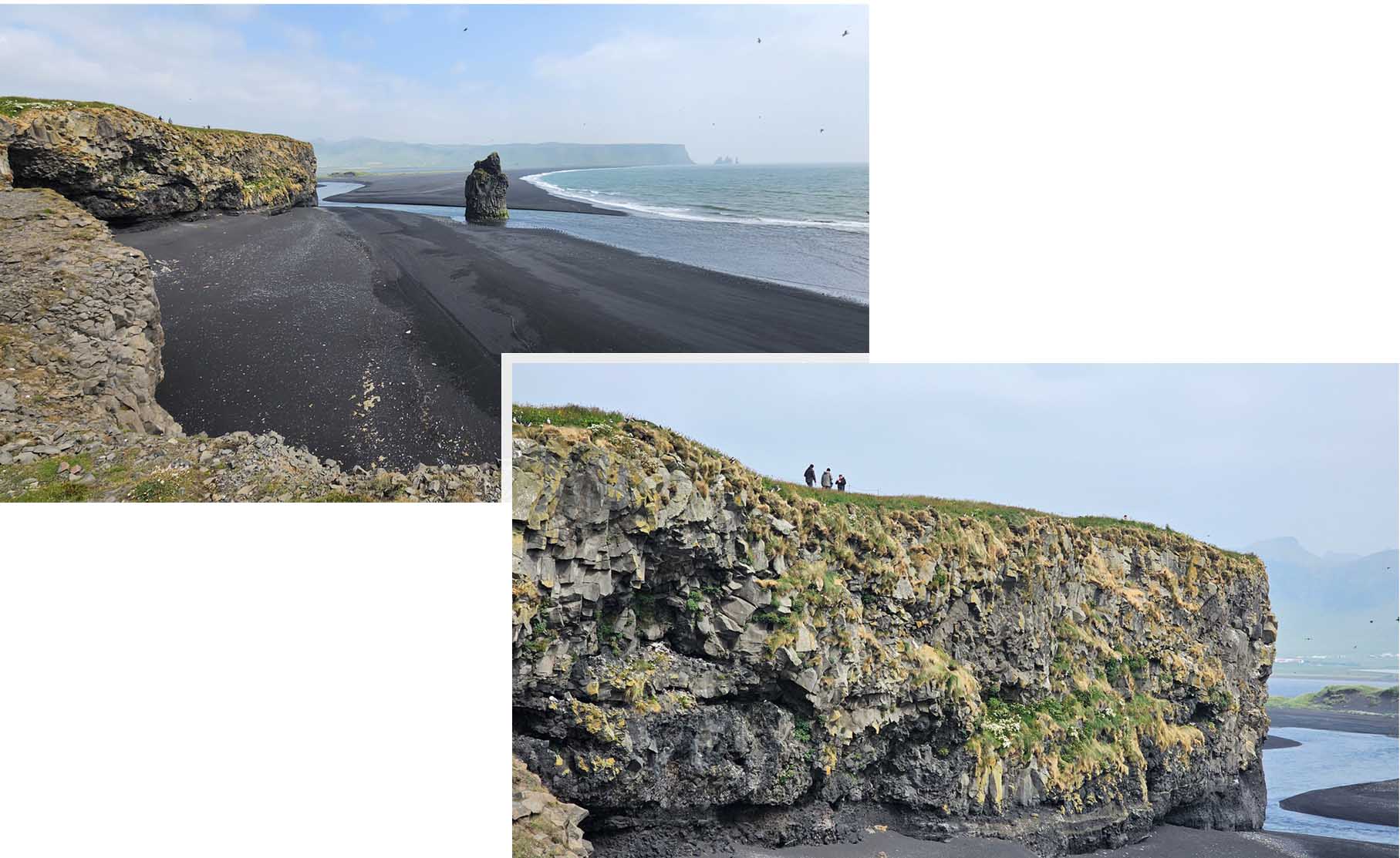
At the” Reynisfjara viewpoint” we saw the world famous Reynisfjara black sand beach. The beach stretched “on and on and on” until it merged with the cloudy mist at the far end.
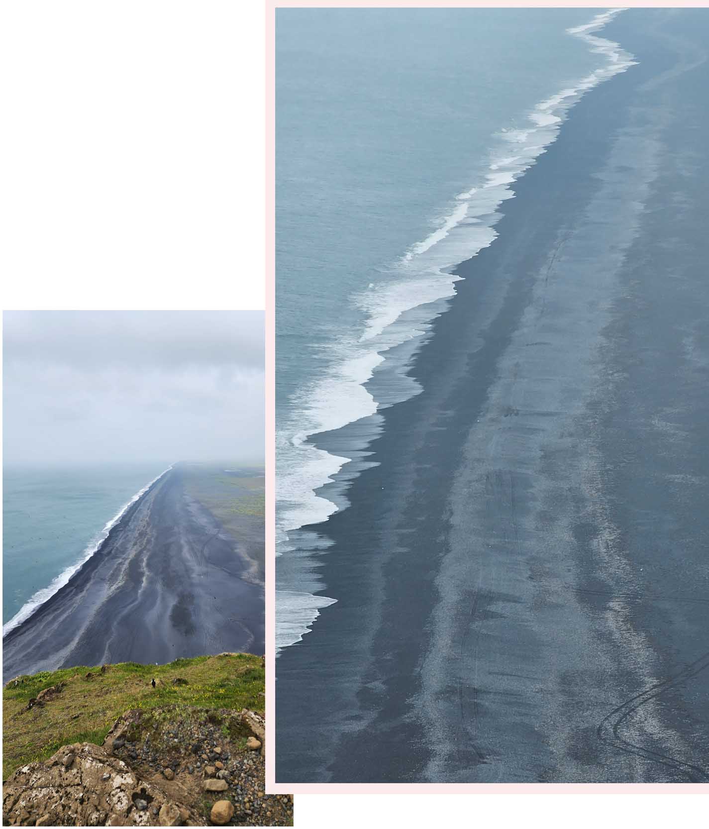
The view was amazing, breathtaking, vast and unique. The cliffs were rugged and jagged and huge.
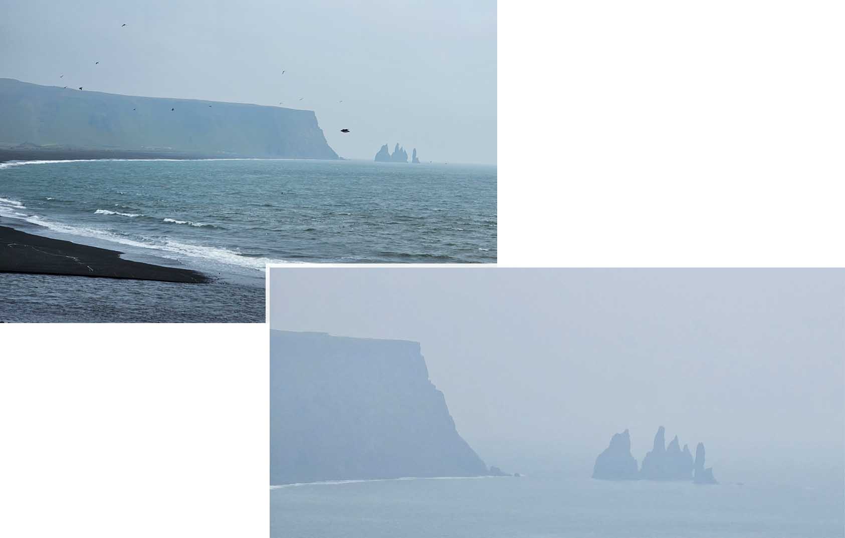
We could see some “finger pointing” rock formations far away. These jagged sea stacks rising out of the ocean were 66m rock pillars called Reynisdrangar. Legend said that two trolls murdered a human woman and her mourning husband hunted them down and turned them into rock.
Puffins
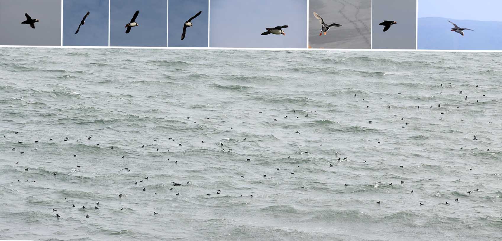
We saw some visitors looking down the edge of the cliff and then we realised that there were puffins on the cliff walls! These puffins had built their nests in the jagged rock walls of the cliff below us! They were flying in and out of their nests, flying out to sea to catch their “food” and coming back to their nests to feed the youngs!
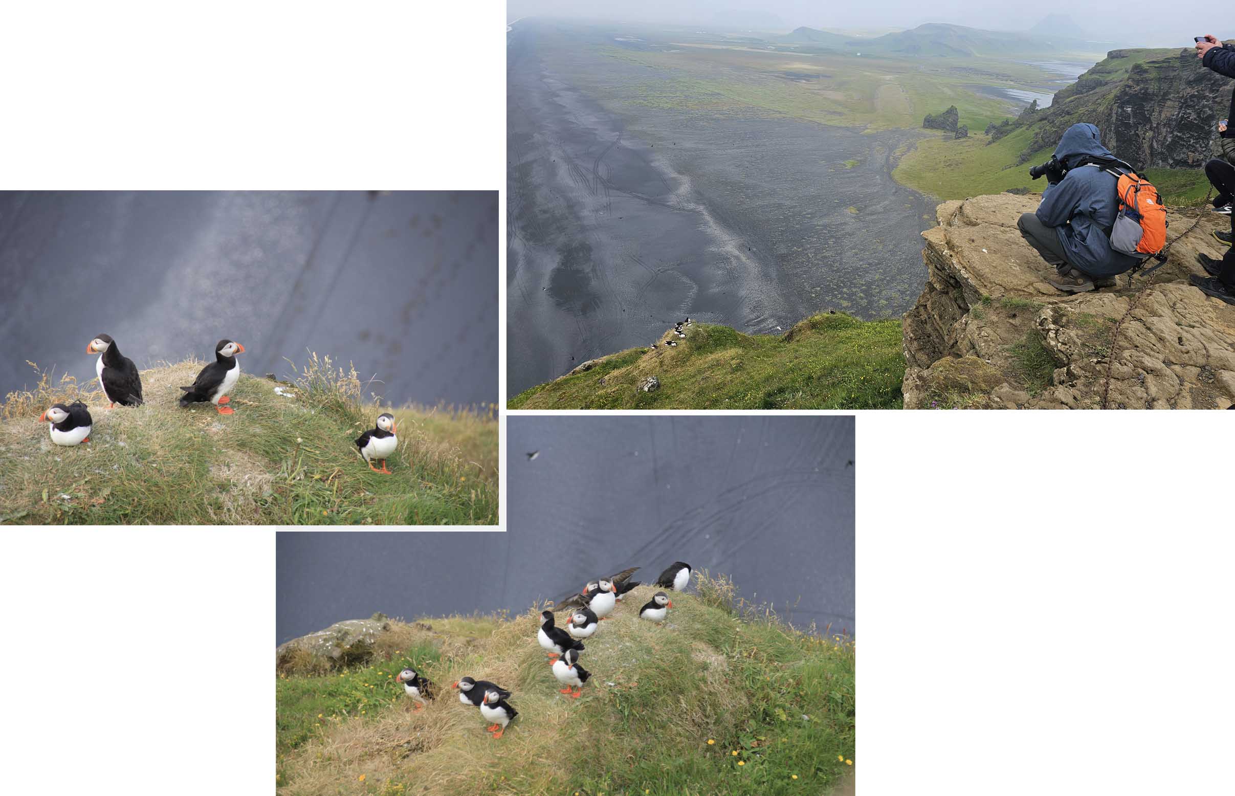
Puffins on the cliff wall of DyrholaeyThe puffins were so cute and adorable, they were smaller than our expectation. It was our first experience seeing puffins in the wild. The puffins had bright orange legs and orange beaks and according to what we had read, in winter the orange color were less apparent the color came back when spring began.
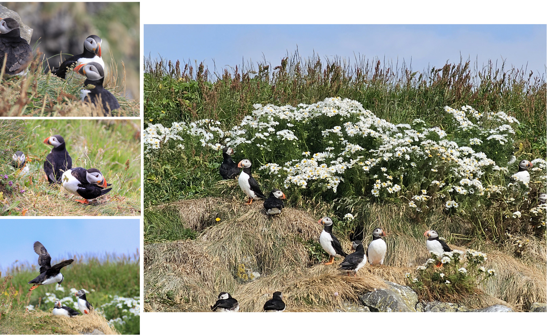
The puffins fascinated us, and we dragged our feet leaving Dyrholaey. We had planned to see puffins at Latrabjarg (famous for puffin sighting) which would be in the later part of our trip. We did not do enough “puffin” research and was not aware the Dyrholaey Peninsula was one of Europe’s largest puffin colonies. It was awesome that we did not miss the “puffin” sights at Dyrholaey!!
Far out in the sea we saw many black “dots” floating in the wave, they were all puffins! Wow it was amazing to see so many puffins, there were thousands of them!
Vik Village
From Dyrholaey Peninsula we drove for about 18 km to Vik Village for a coffee break. Vik was the southern most village of Iceland.

Vik was located directly south of Myrdalsjokull glacier which itself sat on top of Katla volcano. Katla, was a subglacial central volcano that was one of the largest volcanoes on the island. A major eruption of Katla could melt ice and cause a flash flood that might obilterate the entire village of Vik.
There were three minor subglacial eruptions in June 1955, July 1999, and June 2011, and the last major eruption occurred in October 1918. Katla typically erupted every 20-80 years but it had been more than 100 years since the last major eruption and a big one was expected soon/anytime.

Vik looked like a nice town, with many accomodation available to visitors. It had a church up the hill. We came upon Kronan a discount store/supermarket and went in to pick up some grocery and a TUB of Icecream. We sat at a picnic table/bench by the carpark and had a great coffee/icecream break!
Yoda Cave
After coffee break it was about 3 pm, the day was early so we decided to visit Yoda Cave which was originally planned for the next day. The great thing about staying nearby (The Barn) was there was no need to cater for additional “driving hours” to our hotel..

It was a short drive from Vik village to Yoda Cave. We turned right from the Ring Road and drove about 2.5 km, here the road was unpaved but still easy to drive on. We parked our car at the end of the unpaved road and walked a short distance to Yoda Cave. The cave was not very big but its shape was definitely distinctly familiar!
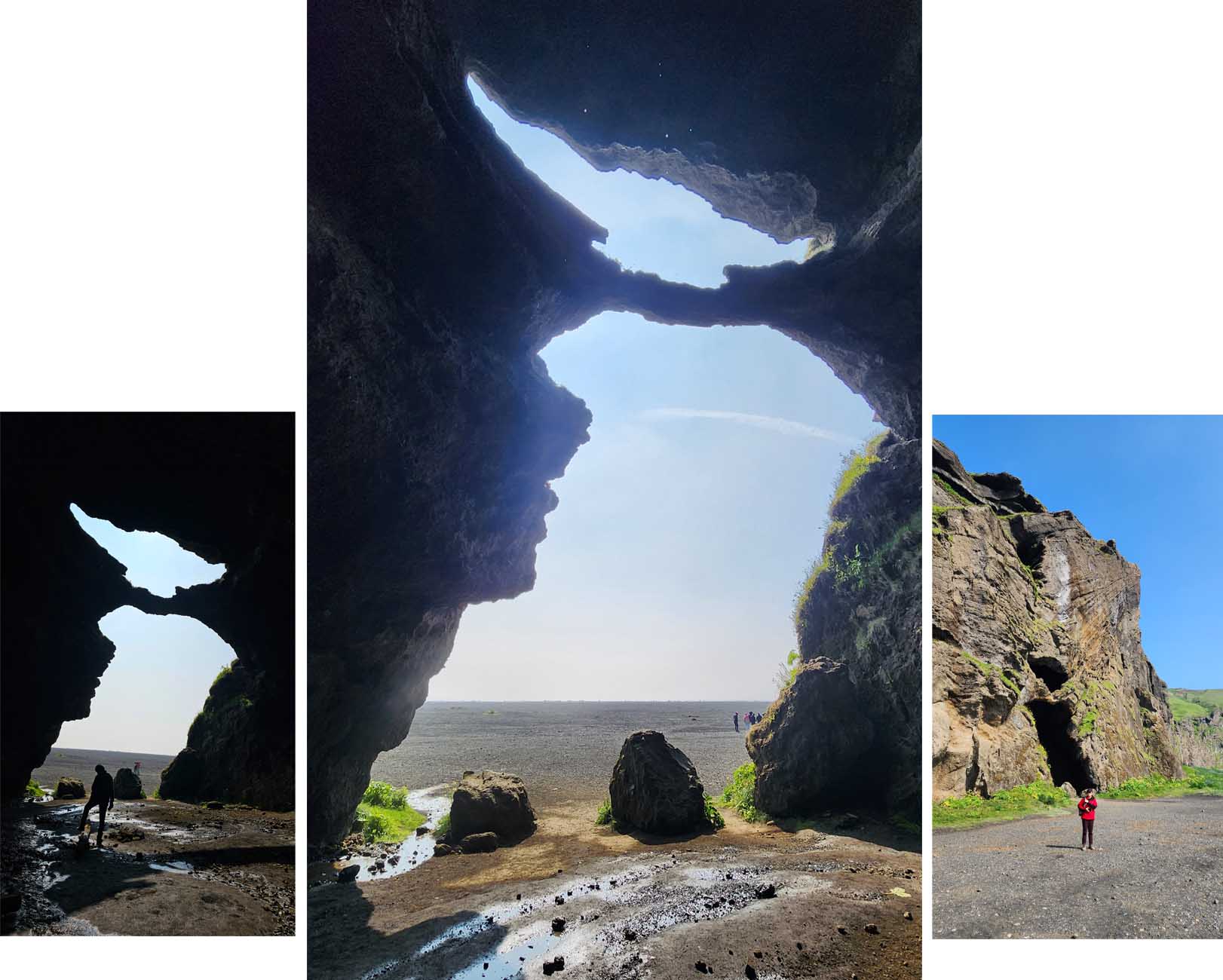
Yoda CaveThis cave was a natural wonder and had an unusual resemblance to Yoda of Star Wars which accounted for it new name “Yoda Cave”. Its native name was Gigjagja.
Reynisfjara Black Beach & Reynisdrangar
Reynisfjara Black Beach was our last destination for the day. We had seen the beach from afar in the morning when we were at Dyrholaey Penisula but for this visit we were stepping onto the beach.
Before the day was over we visited Reynisfjara Black Sand Beach twice, once at 4.30pm and the second time 5 hours later at 9.15pm. From our stay, The Barn, it was just a 5 min drive to Reynisfjara Black Sand Beach.

At 4.30pm the sun was high up in the sky, the beach was shining black, the sky was blue and clear. Looking west there was only a tint of gold of the setting sun.
On the beach was Halsanefshellir Cave. It was a shallow cave carved by the relentless force of the North Atlantic Ocean over millennia. The entrance to the cave was stunning, from afar it seemed like bundles of rock columns were arranged to create a cavern. This rock columns were basalt columns formed from the cooling of lava. During the cooling process the many cooling centers created forces that pull inward (toward the centers) creating different chunks of cooling lava forming near hexagonal sides.
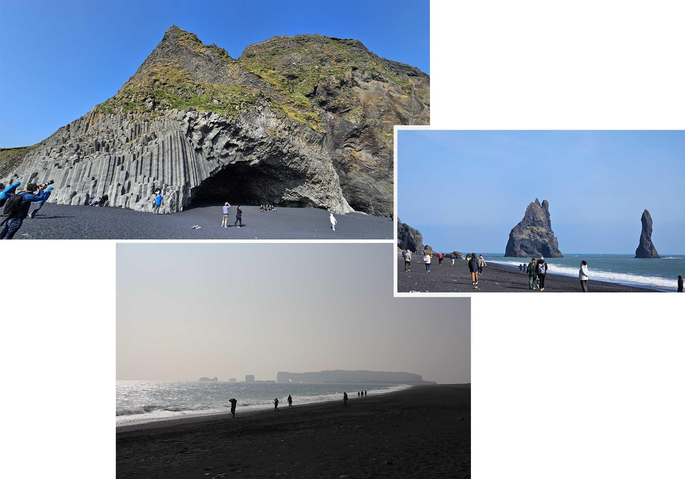
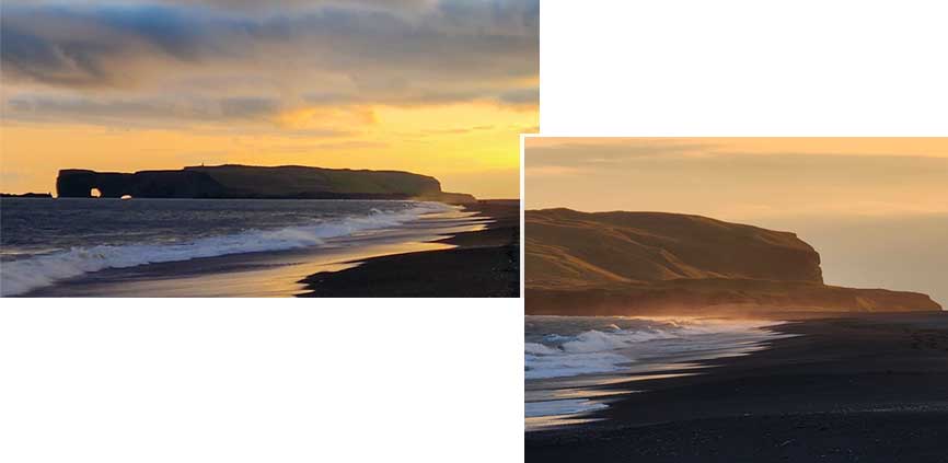
On Reynisfjara Black Sand Beach we had a closer view of Reynisdrangar (pointy rocks formation in the sea) which we had seen earlier when we were at Dryholaey Penisula in the morning. Standing on the Reynisfjara Black Sand Beach we looked west and saw Dyrholaey Peninsula and the Arch which appeared very small.
After about an hour on Reynisfjara Black Sand Beach we decided to return to our stay (The Barn) to rest, relax, prepare and eat dinner before coming back to Reynisfjara Black Sand Beach at around 9 pm so as to view the place under the “setting sun” atmosphere.
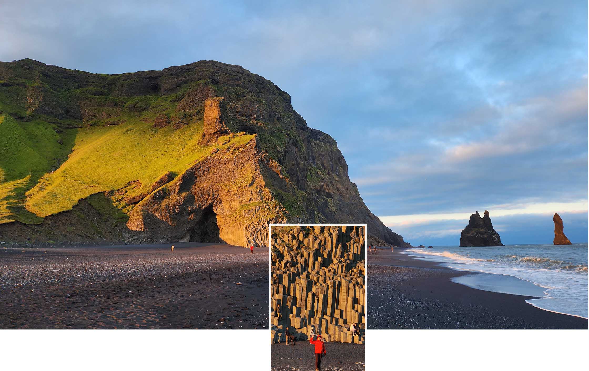
It certainly was a good decision to come back near sun set time. The place was absolutely more beautiful than before. The basalt rock columns on the entrance of Halsanefshellir Cave had changed from the gray to gold color. One the pointy rock formations of Reynisdrangar which looked dark gray in color at 4.30pm had turned redish brown in color.The black sand, the waves and Dyrholaey Peninsula looked stunning with the setting golden backdrop!
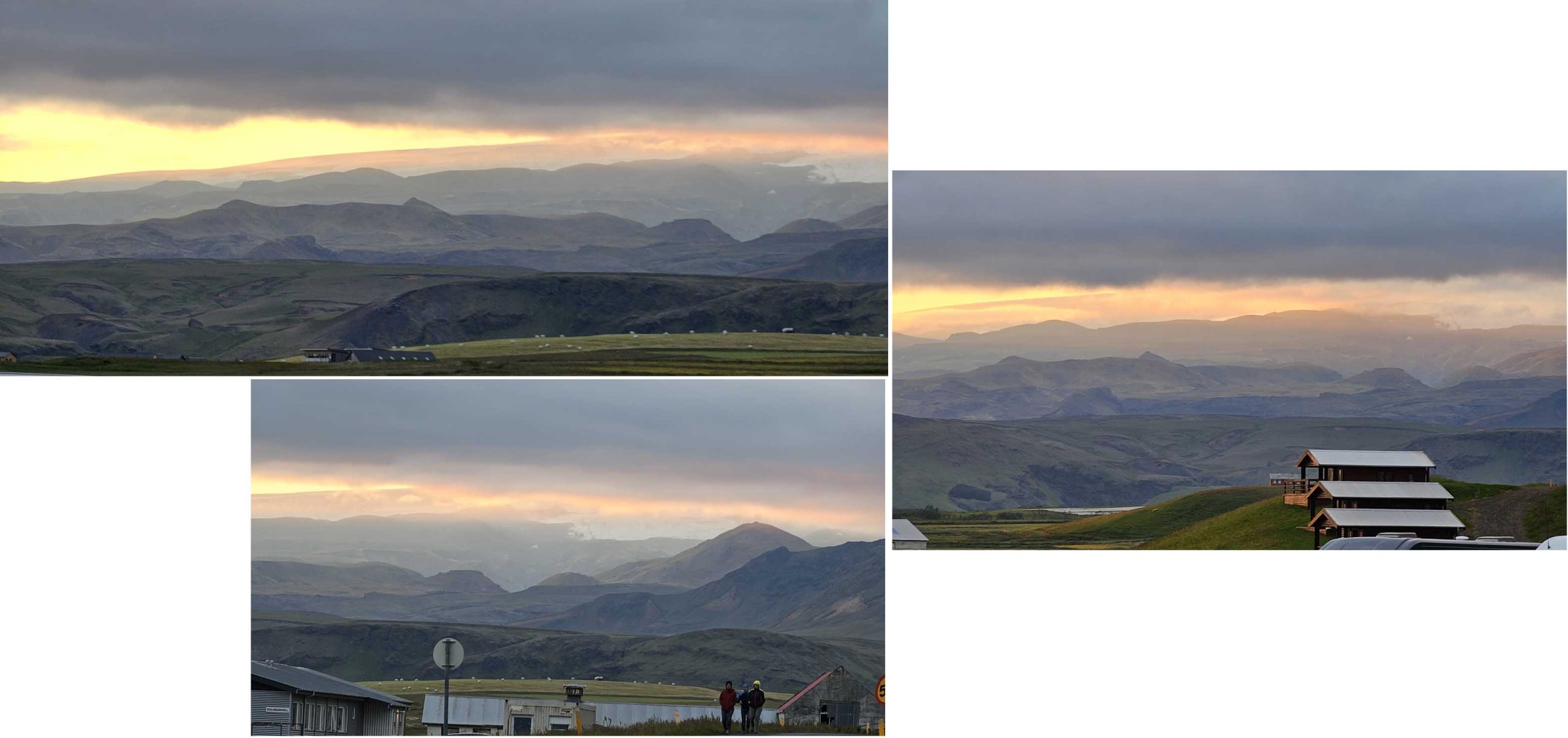
At about 10pm we drove back to our stay and along the way we were treated with more gorgeous sunset view of the hilly terrains in the far distance. A lovely end to a beautiful day!