Crossing Breiðafjörður Bay to Snæfellsnes Peninsula
After about seven days of visiting various scenic places of Westfjords we were really to leave and our next destination was Snæfellsnes Peninsula. From Westfjords to Snaefellsnes would either be a 3.5 hours of long driving or a ferry transfer plus some driving. We opted for the easiler route.
There was a car ferry that sailed across Breiðafjörður Bay from Brjánslækur in Westfjords to Stykkisholmur in Snæfellsnes Peninsula with a short midway stop at Flatey Island.

From our stay at Hagi2-Road62 was a 15 minutes drive of 20km to Brjánslækur ferry pier. We had bought our ferry tickets for two adults and a car from Seatours Website (http://www.seatours.is) two days ago. The tickets costed a total of ISK 19,470 (ISK6,490 per person and ISK6,490 for the car). We could have bought the tickets on board the ferry as there was no ticketing counter at the ferry pier but preferred to buy tickets online to guarantee a spot on the ferry.

In summer there were two ferry trips a day crossing Breiðafjörður Bay. We were on the first trip which sailed at noon from Brjánslækur. We reached Brjánslækur jetty about 30 minutes before sail time and there was already many cars in a queue.
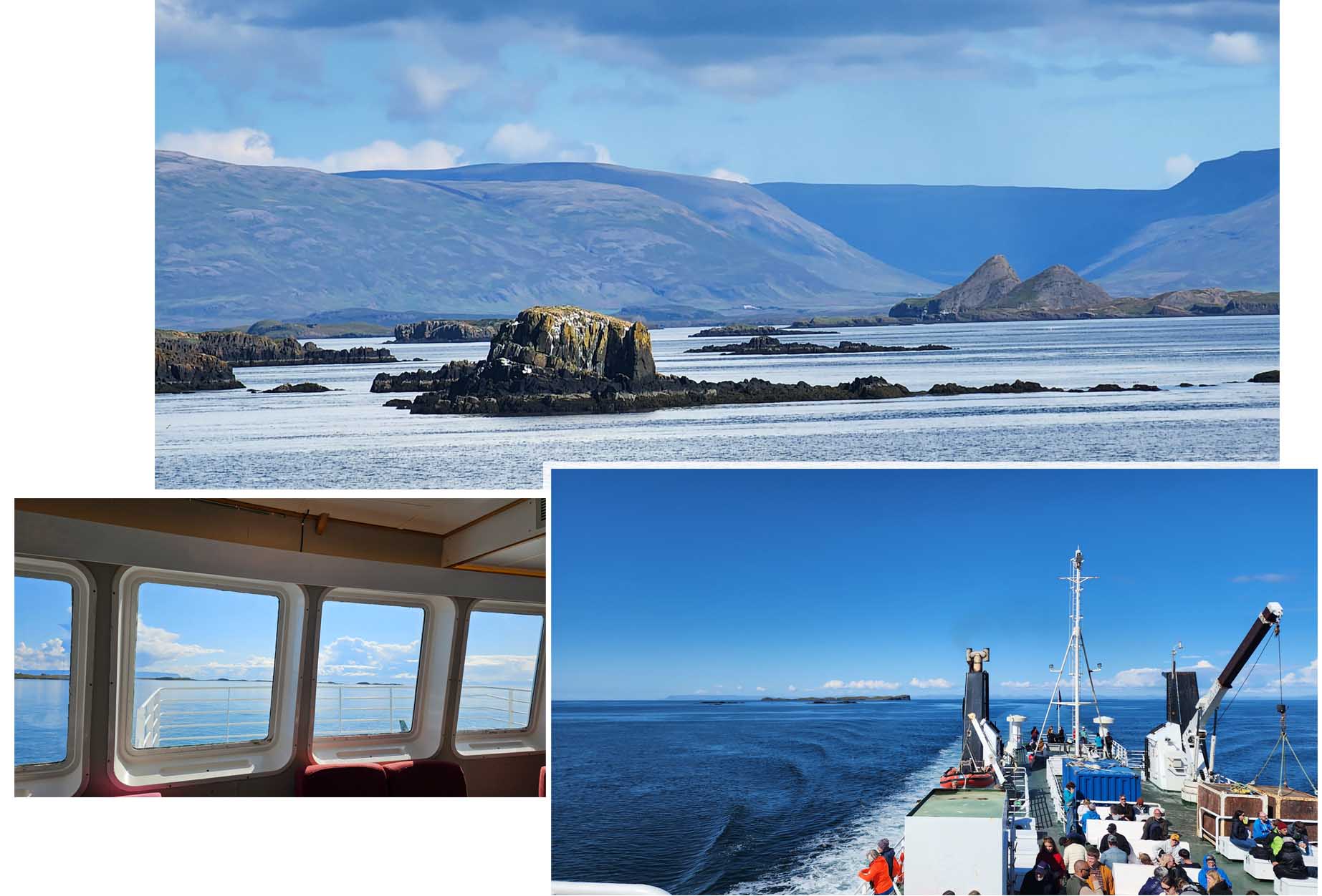
On the ferry we started our trip sitting in the enclosed passenger lounge, but after a while we went to the open upper deck to enjoy the wind and and scenery. After 1.5 hour, the ferry made a stop a Flatey Island, it was a short stop of about 5 to 10 minutes so we did not bother to disembark.
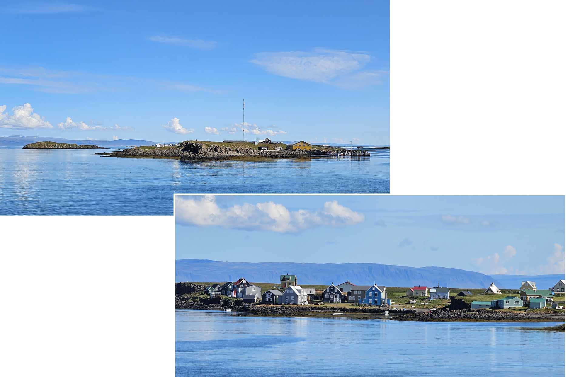
On Flatey Island there were several colourful houses. We read that in Summer when some residents returned to the island, the population could rise to a few dozens but in the winter the population dropped down to a handfull. Those tourists that choose to disembark on Flatey Island could boarded the 2nd ferry of the day which was 5 hours later.
Snaefellsnes
Snaefellsnes peninsula was a scenic region on the west side of iceland. It had many interesting sights and attractions that we decided to book a four night stay on one of the accommodations on the peninsula so that we could visited these attractions at a relaxing pace over four days.

This peninsula had a length of about 90km stretching from the West side Iceland. It had Reykjanes Peninsular in its south and Westfjord to its north. Along the peninsula was a mountain range consisting of bothe active and dormant volcanoes.
Kolgrafarfjordur Viewpoint
Our ferry reached Stykkisholmur Pier at about 3 pm. We drove off the ferry and was on our way to our accommodation, Helgrindur Guesthouse some 38 km away. Stykkisholmur Pier and its surrounding area looked interesting but we did not want to explore the place till another day. We wanted to check in early, picked up some grocery and rest and relax for the rest of the day.

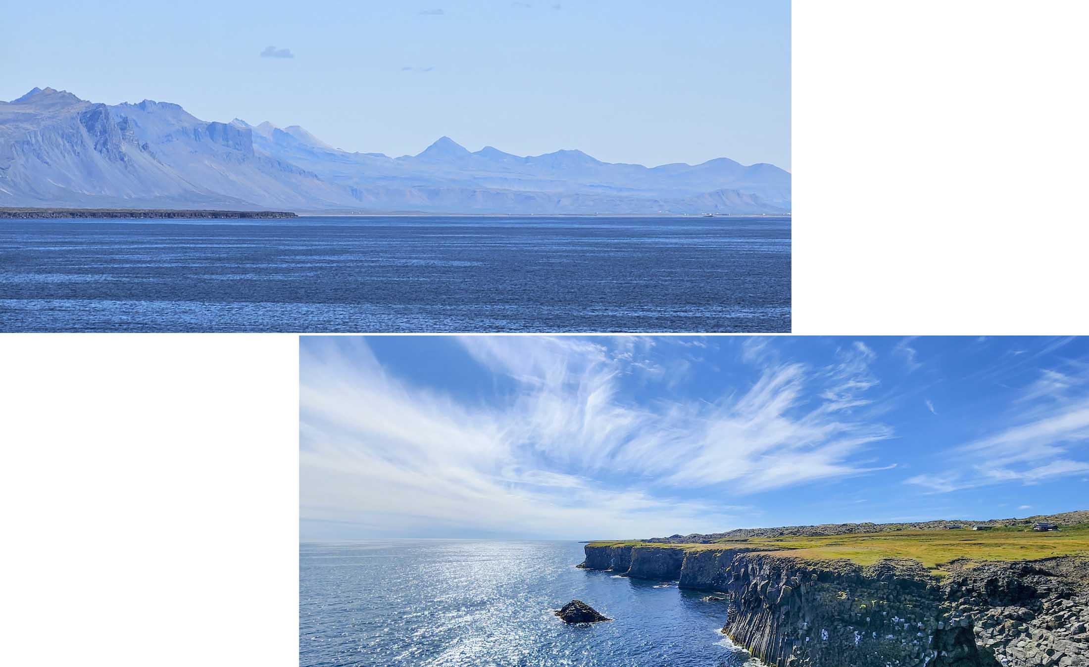
On the way to our stay we stop at Kolgrafarfjordur Viewpoint. The scenery was stunning! We were probably there at the right time of the day on a “right” weather day!
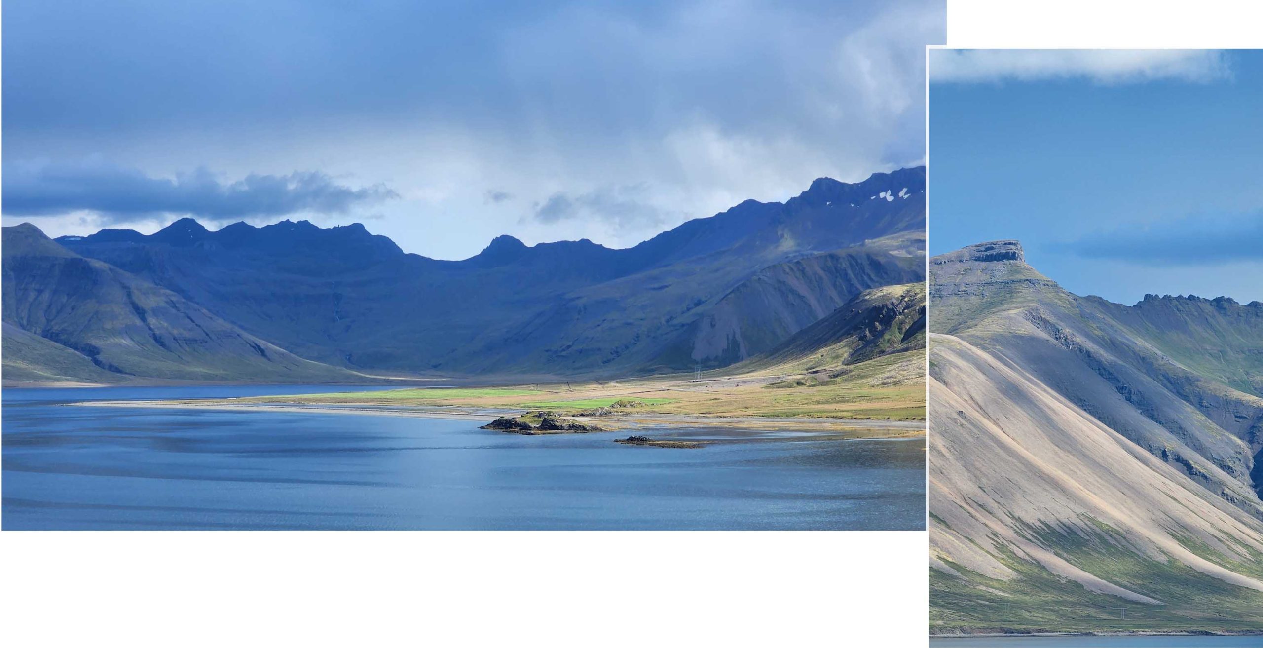
The scenery in front of us was amazing, it looked “silky”. The water looked bluish and silky, the hill slope looked light gold and green and silky and even the sky with rays that penetrated the clouds painted the atmosphere with fainted silky shades of blue.
Kirkjufell and Kirkjufellsfossar
Kirkjufell and Kirkjufellsfossar were two of the main highlights of Snaefellsnes Peninsula. They were both just three km from our stay. In fact we could see Kirkjufell from the windows of our stay.
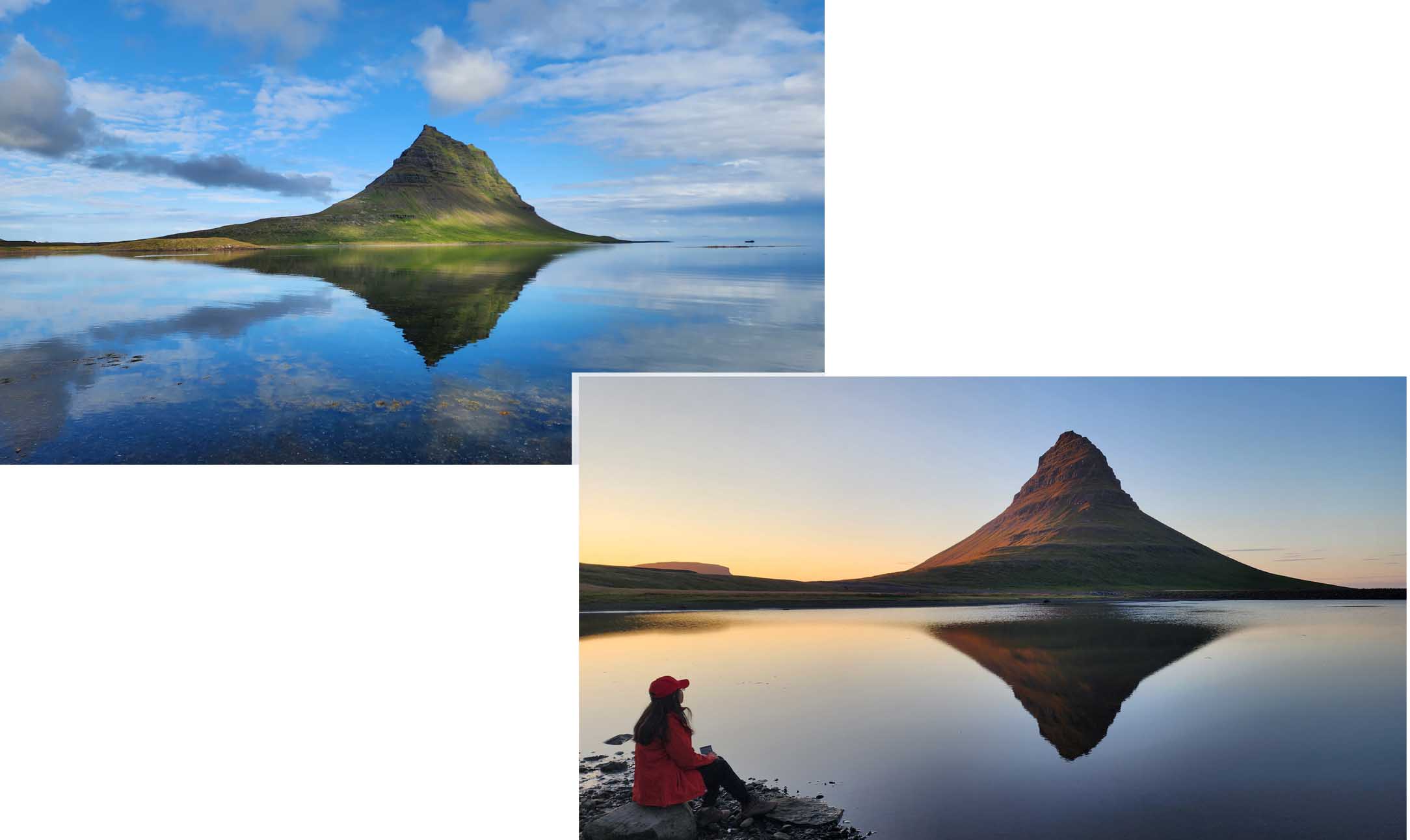
Over the next three days we visited Kirkjufell and Kirkjufellsfossar severals time, seeing them from different positions/angles and during different parts of the day. At different positions the shape of Kirkjufell varied. At some positions Kirkjufell looked conical hat and other positions Kirkjufell looked like a conical hat with a sloppy flatten top.
We were able to catch sunset views were only on two of the four evenings as it was raining,cloudy and gloomy on the other two evenings.
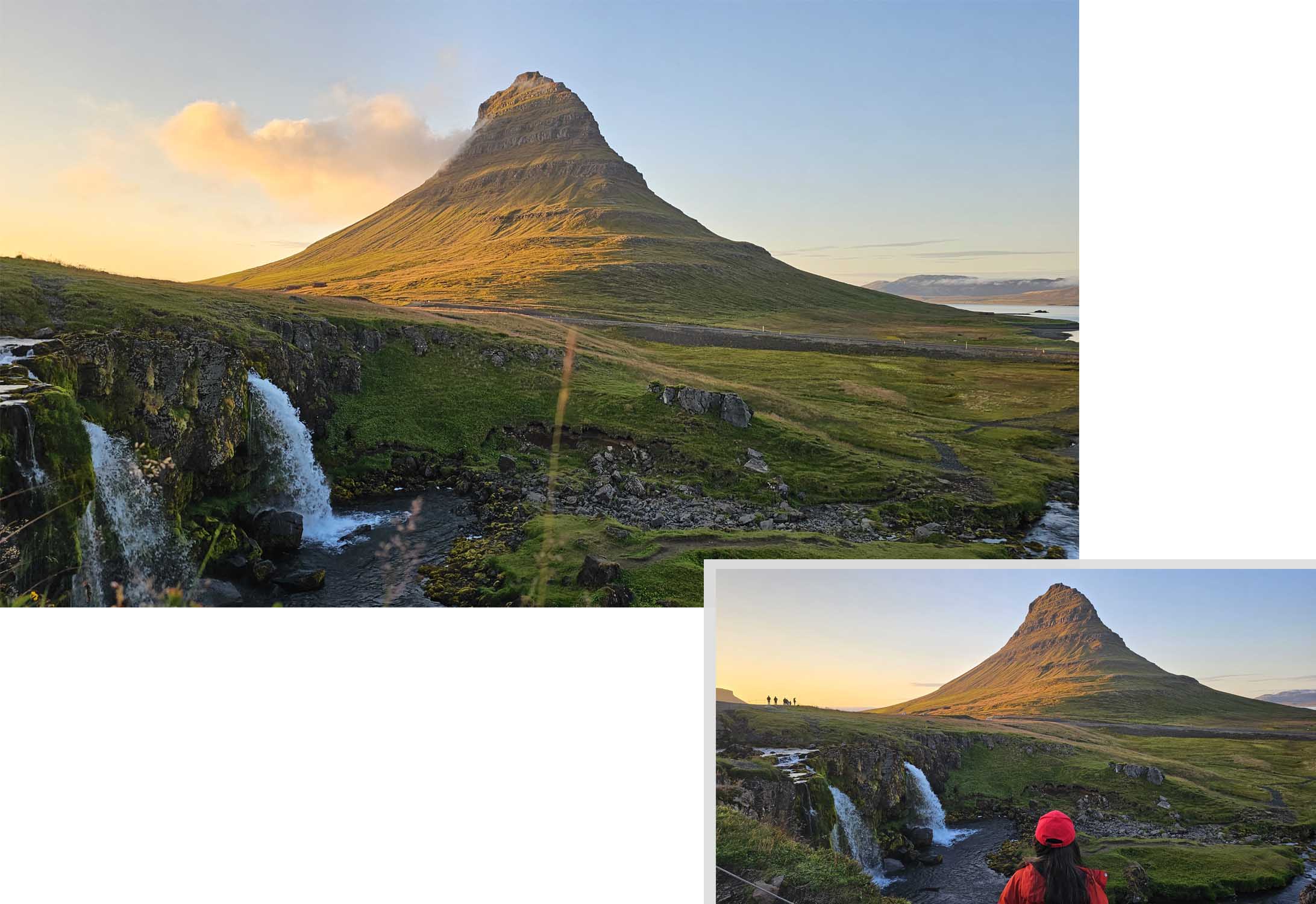
Kirkjufell and Kirkjufellsfossar during sunsetWe visited Kirkjufellsfossar on our second evening on Snaefellsnes Peninsula. There were two parking lots, the one further from the falls was free and the nearer one charge a fee for parking. We parked at the free carpark and walked about 100 meter to the falls. Surprisingly at sunset time there were many people at the falls with their cameras and tripods set up, waiting for the rays to cast a golden sheen on to Kirkjufell. It was a pretty sight to have the twin falls infront and the gold mountain in the background.
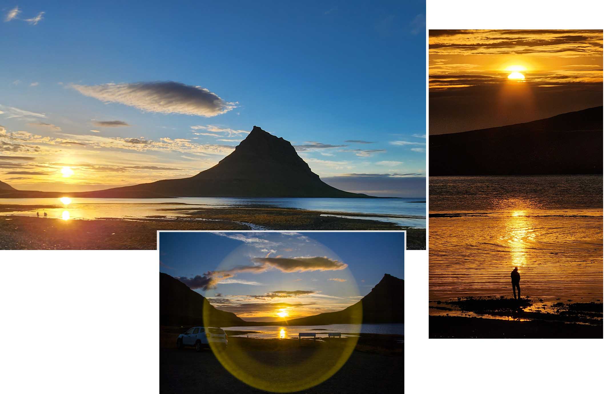
On our third evening we visited Kirkjufell at another position and were treated with a marvelous golden sunset. This time we had a golden sun casting its reflection in a bay of water at the base of Kirkjufell.
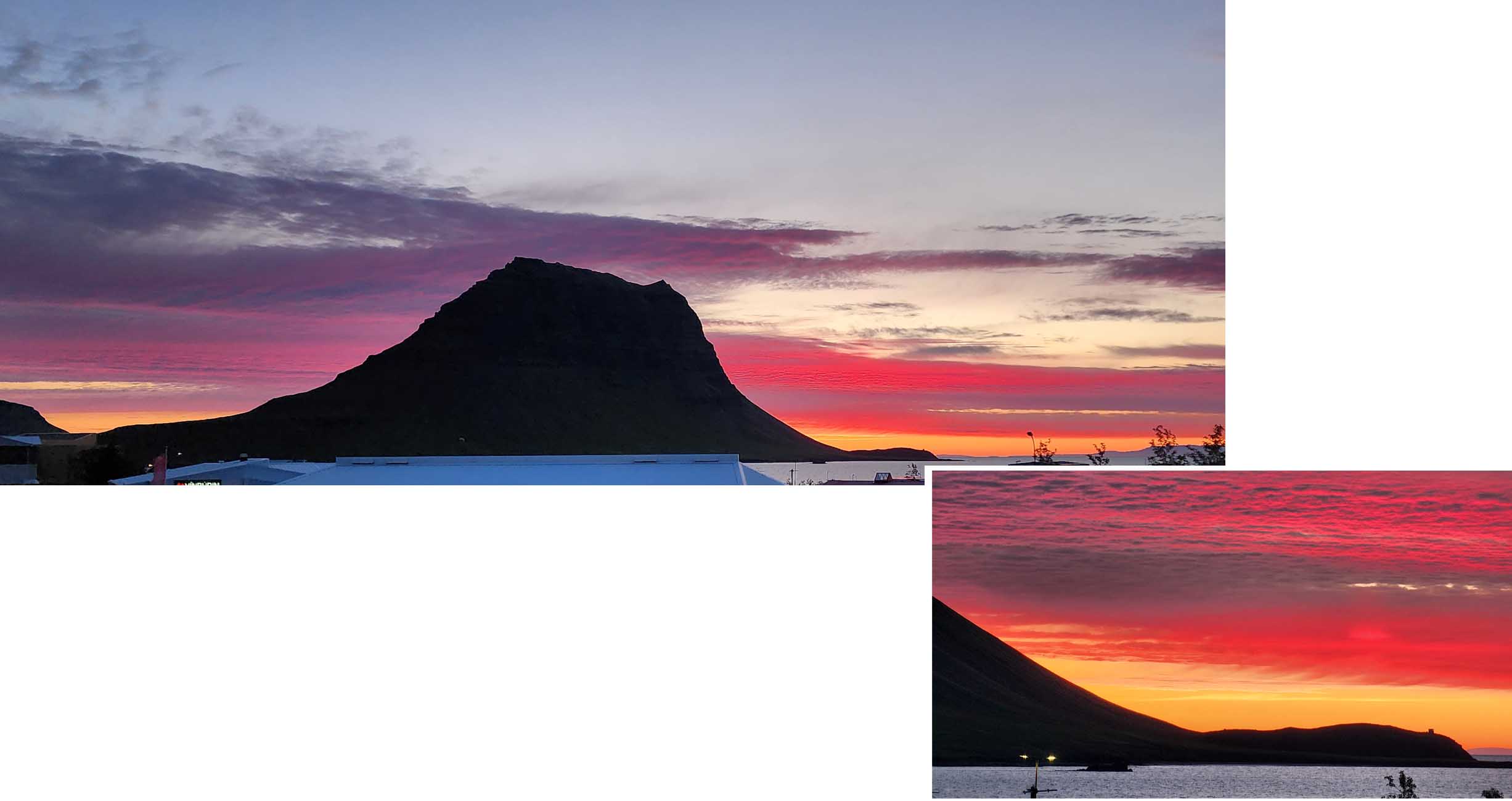
And again another evening after the sun had set, while we were back at our stay, we had a lovely view of Kirkjufell from our balcony. This time the surrounding colours were these magical, red, gold pink shades.
Grundafoss
This was a 70 meter tall falls about 2.3 km from our “stay”. It could be seen from the main road and we saw it many times from afar when we left our stay and when we returned to our stay at the end of the day.
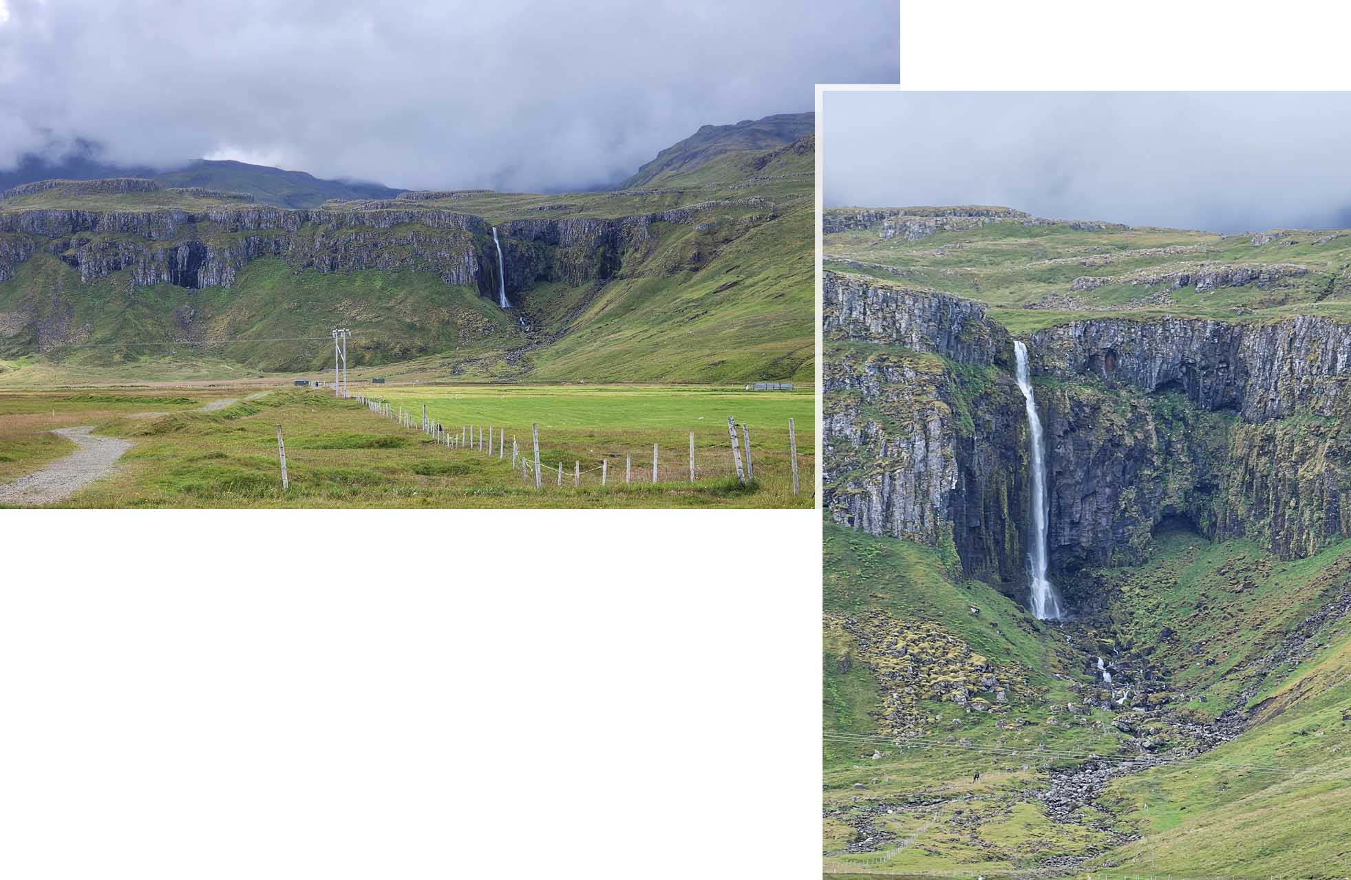
The falls was practically at our “doorstep” so “reachable” that we did not felt the urgent need to explore the falls in the early days of our four days on Snaefellsnes Peninsula. At the end of our stay on peninsula we still did not went close to explore the falls. We just admired it from afar.
Stykkisholmur Pier
We were back to Stykkisholmur Pier to do some grocery shopping, a coffee break and some sightseeing. There was a big supermarket (Bonus) near the pier so much better than the tiny supermarket a few doors from our “stay”.

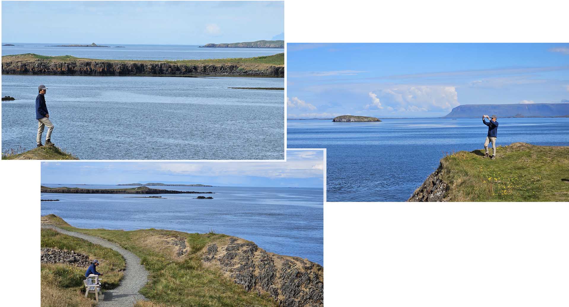
Stykkisholmur was biggest town on the peninsular so there were several cafes, shops, hotels and apartments in the area. Near the pier was an island “Sugandisey” which was connected to the mainland by a bridge. The island looked like a high plateau and iit had a red lighthouse sitting on top.

After our coffee break we were off to Sugandisy Island to explore. We had to climb up some steps to get to the top of the plateau. On the plateau was a loop path. The path brought us round the plateau and that gave us a 360° view of the surrounding.
Selvallafoss
Selvallafoss was one of the more beautiful falls on the peninsula. It was about 25 km east of our “stay”. Surprising there was no one visiting the falls when we were there, we supposed that since the falls could not be seen from the main road, not many visitors were aware of its prescence.

Another name for this falls was “Sheep’s falls”. We definitely did not see a single sheep in the vicinity of the falls when we were there. The terrain to the falls was a bit rocky which needed some carefully trekking.
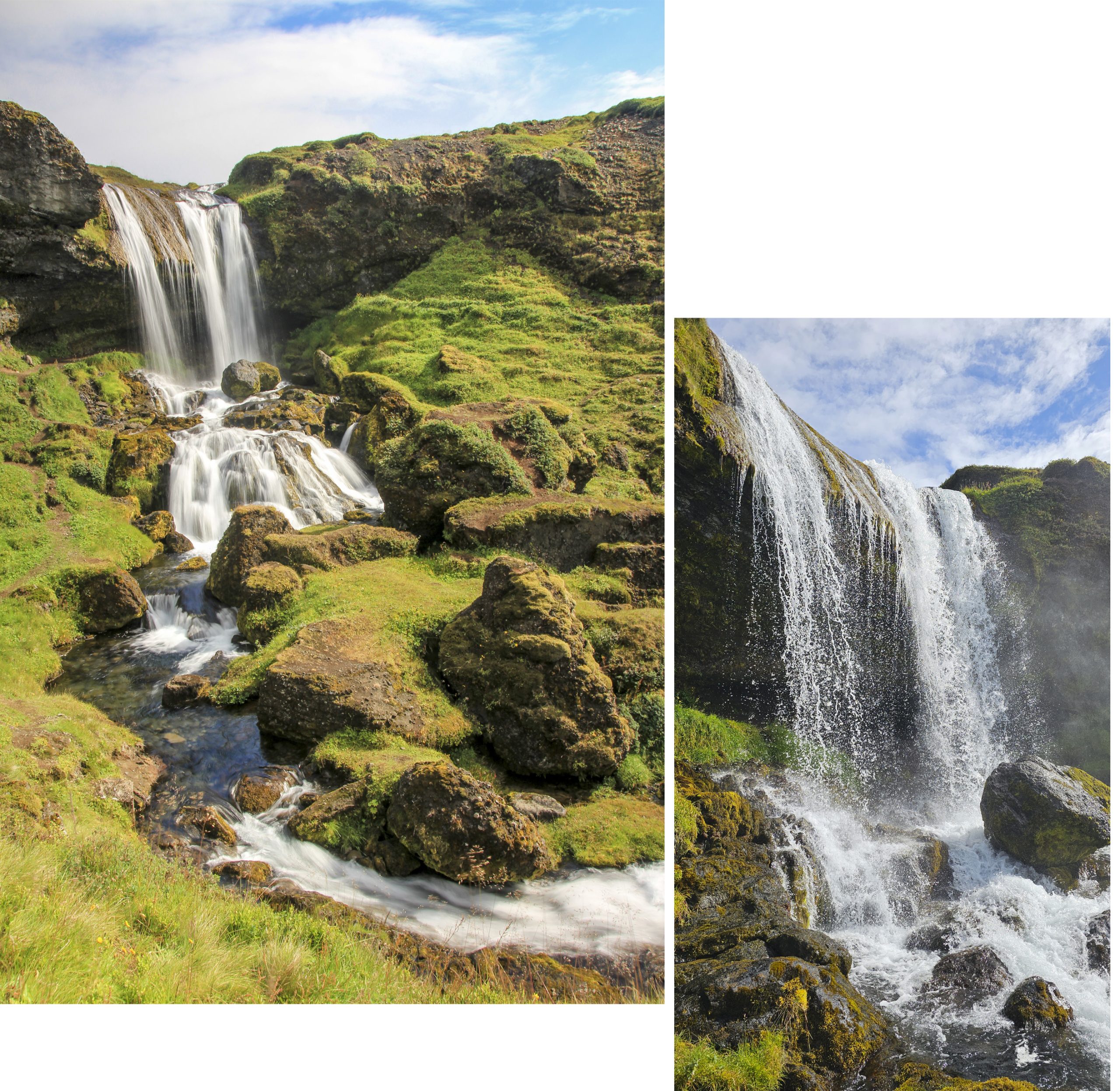
The nearer we got the falls the more we were charmed by its beauty. It was surrounded by lush greenery and the falls had three cascades. Each time we reached one level of the cascade we felt motivated to go up to the next higher level.
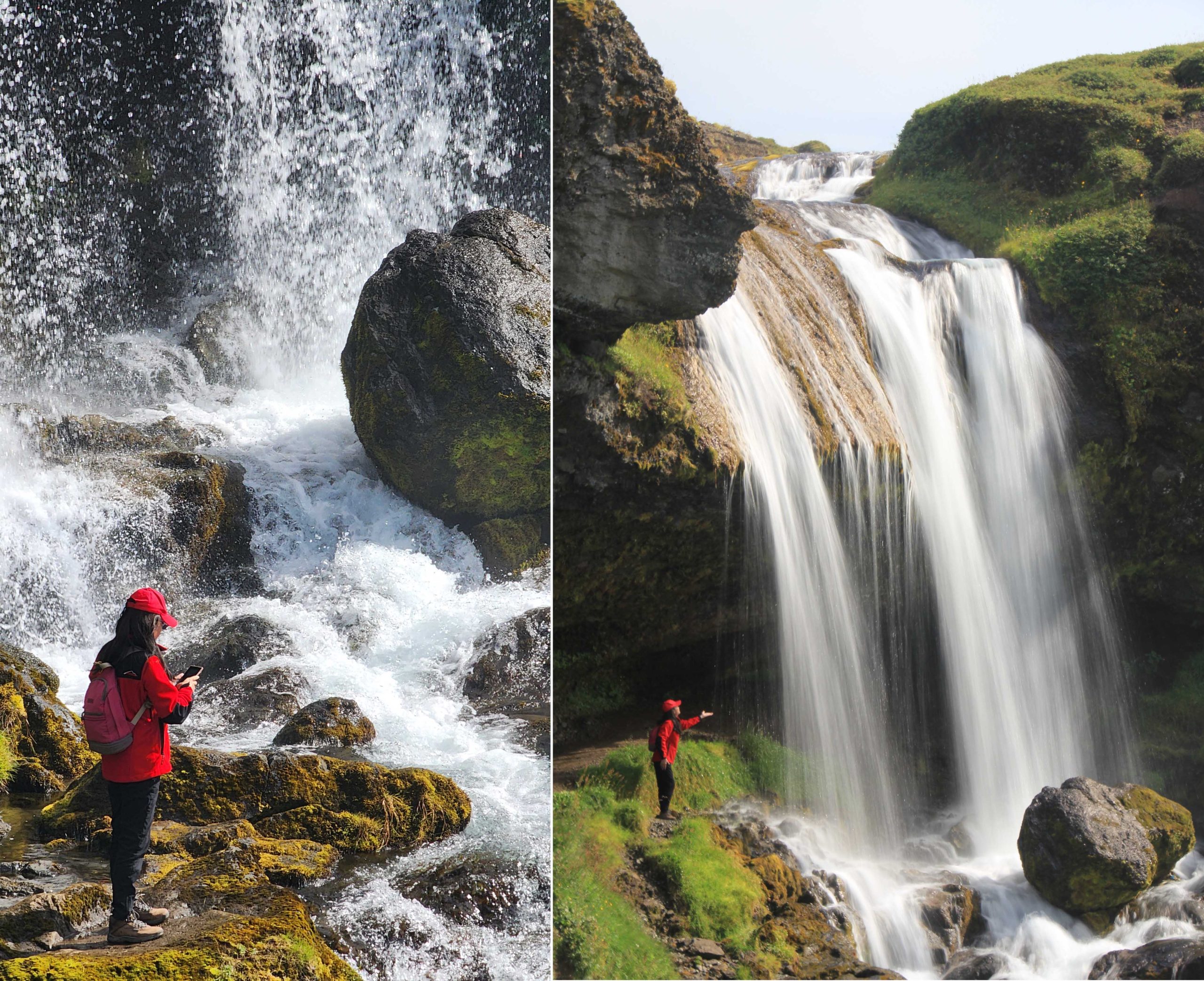
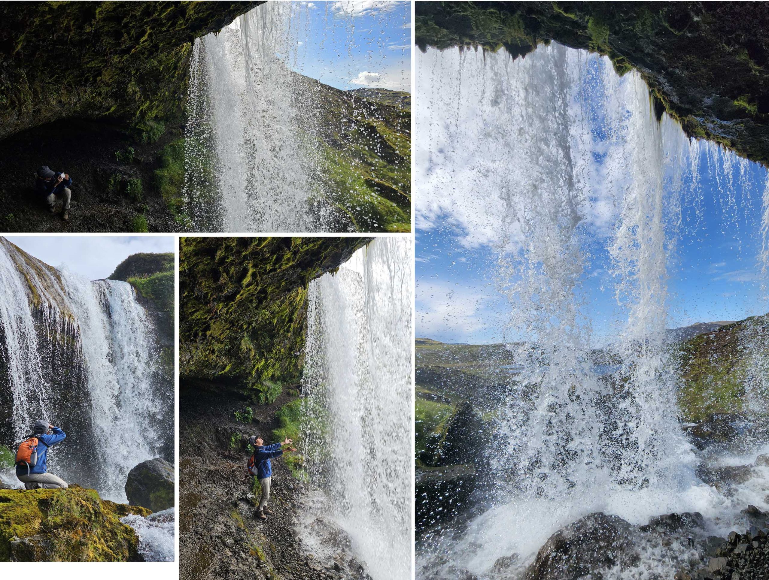
Near the top, we saw a cave behind the falls, unfortunately there was no proper path up to the cave. We had to cautiously manuevered our way up and into the cave and we made it safely. It was lovely seeing the water cascading over our heads!
Bjarnarfoss
This falls was on the southern side of the peninsula and just 35 min drive from our stay. From Road 54 we turned left into Bjarnafoss Road and arrived at a carpark (free parking). From the carpark was 500 m walk to the falls.

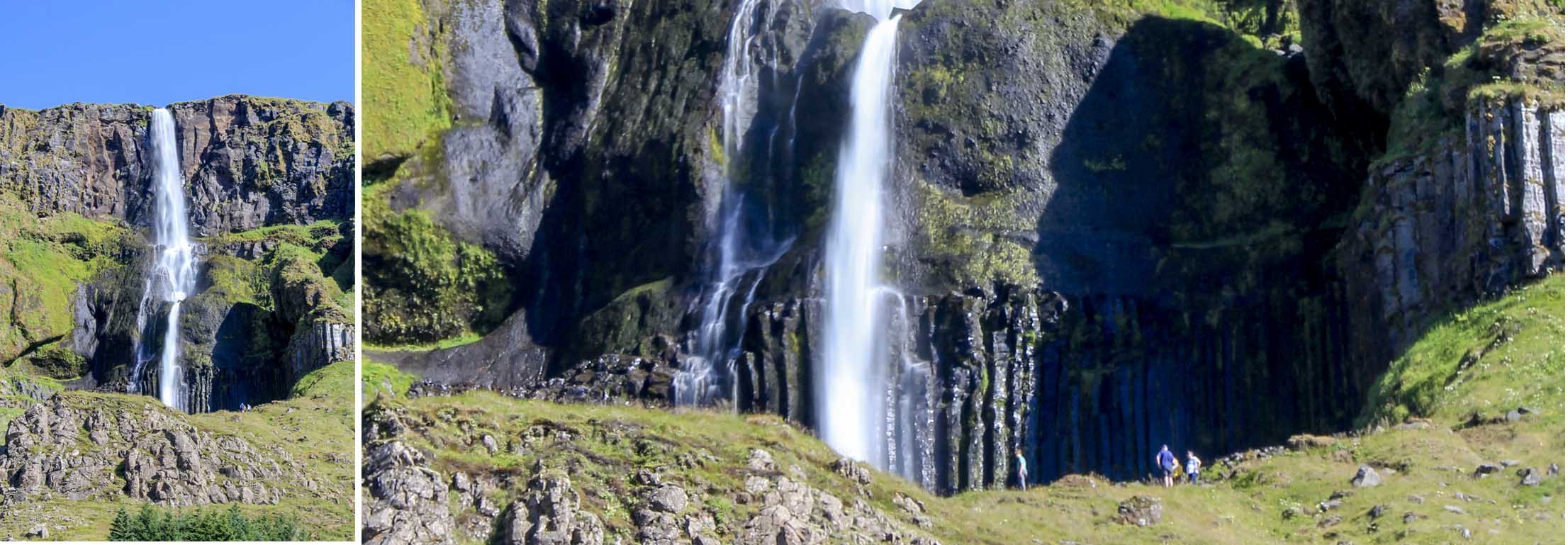
Bjarnafoss looked interesting, it was a 80m tall falls. Its water fell from the top of a high hill and ended “mid-hill”. From far we could not see if there was a pool at mid-hill level that collected the water which flowed down a rocky channel to the based of the hill.
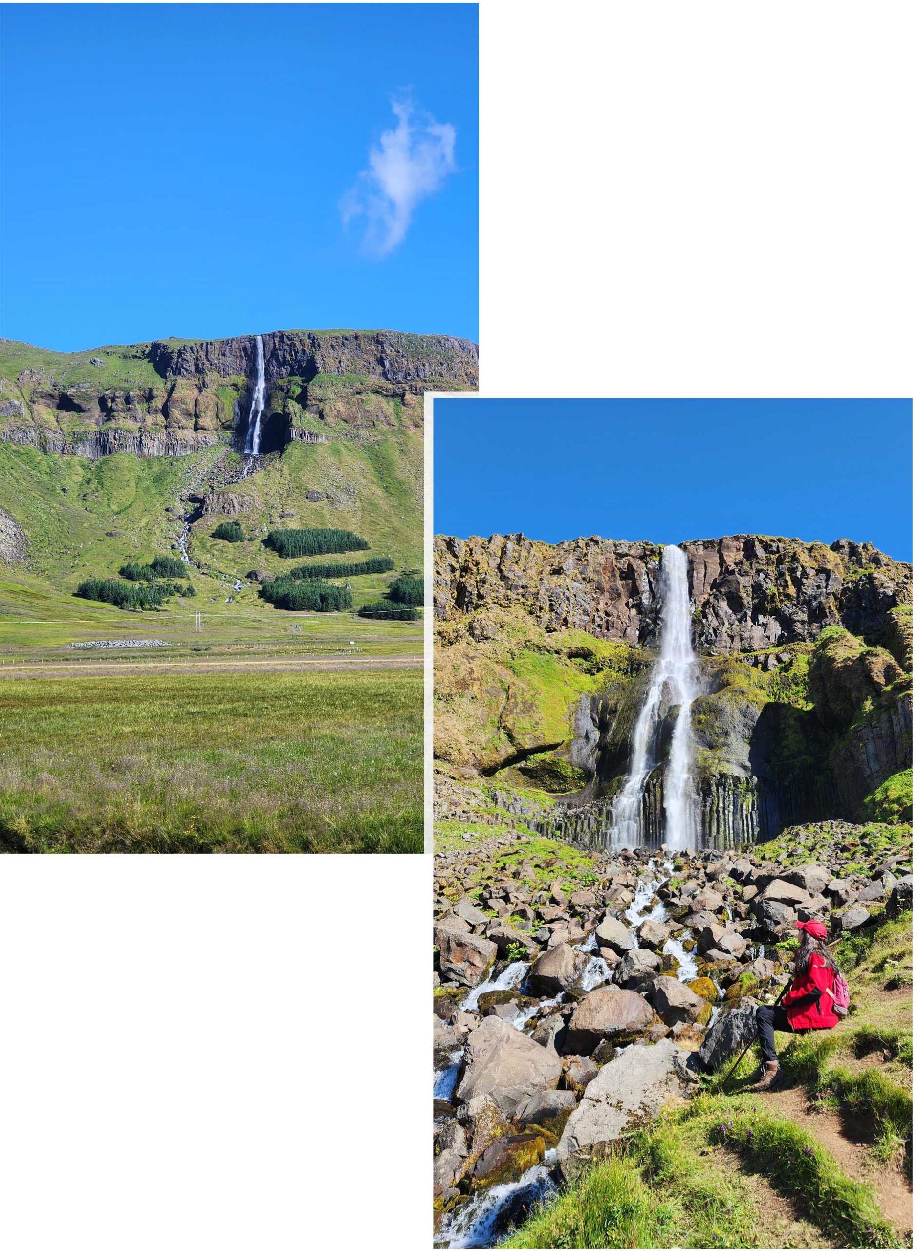
When we reached the base of the hill we saw that there were some visitors at the mid-hill. Wow, how did they get up there? There was no proper path at all! So as usual we scrambled over the rocky terrain, stepping over small rocks and climbing over large rocks as we figured out the best path to go up. Luckily we brought my hiking sticks.
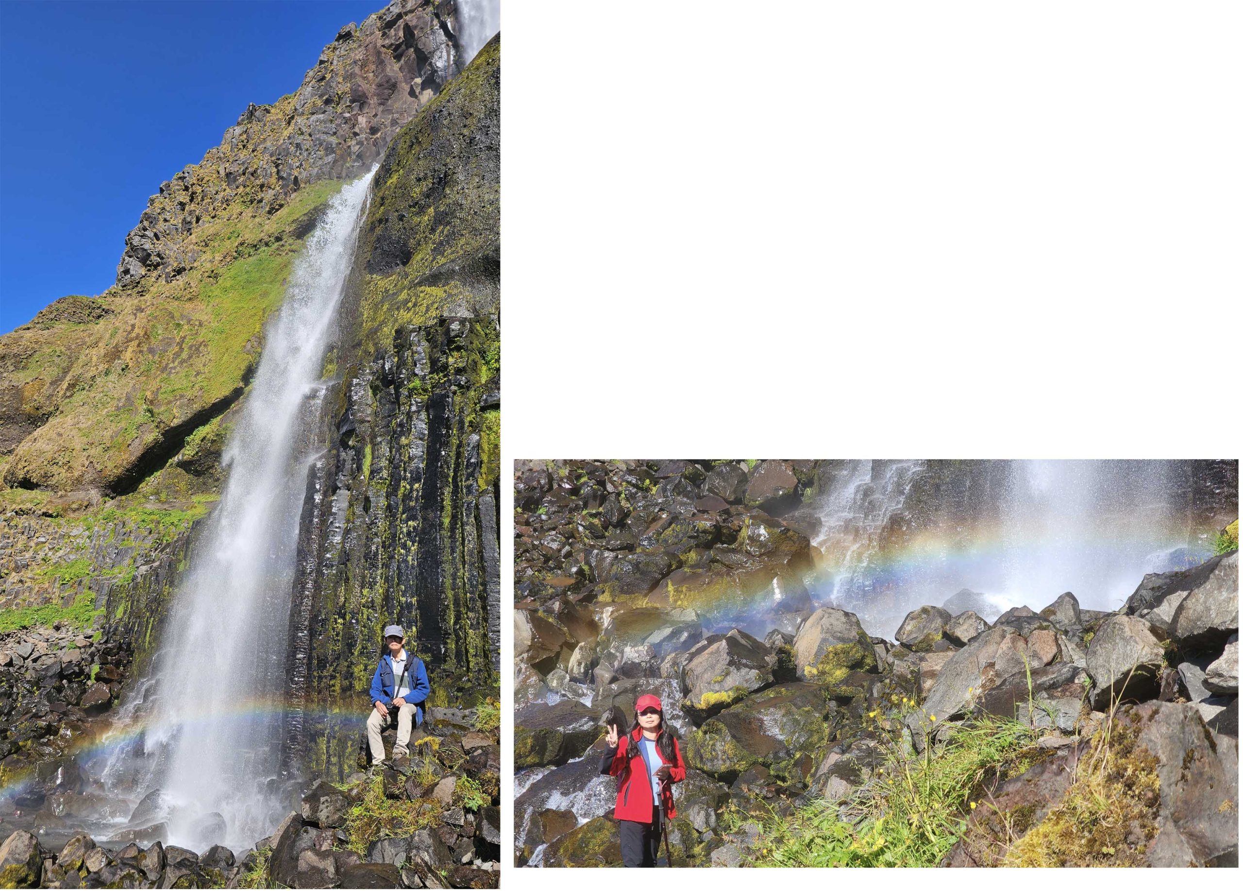
We reached the mid hill and stopped as there was no way to go further up. The water splashed onto the rocky base and created a layer of mist. The sun shown though and we saw a lovely rainbow!
Arnarstapi, Gatklettur, Músagjá, Lóndrangar
Arnarstapi was a small village on the southern side of Snæfellsnes peninsula. It was once a bustling fishing hub but now served as a “service center” for tourists visiting the peninsula offering cafes, restaurants, accommodation etc. We were in Arnarstapi to see some of its most stunning coastal rock formations.

On arrival we saw that there were many tourists. We saw several cafes so we mentally kept notes to visit one before leaving. Parking our car was not an issue as there was plentiful of parking lots. There was a nice stone paved walk towards the coast which lead to Arnarstapi Cliff View Point so we went along that way. There in a few metre we saw an interesting man-made statue.
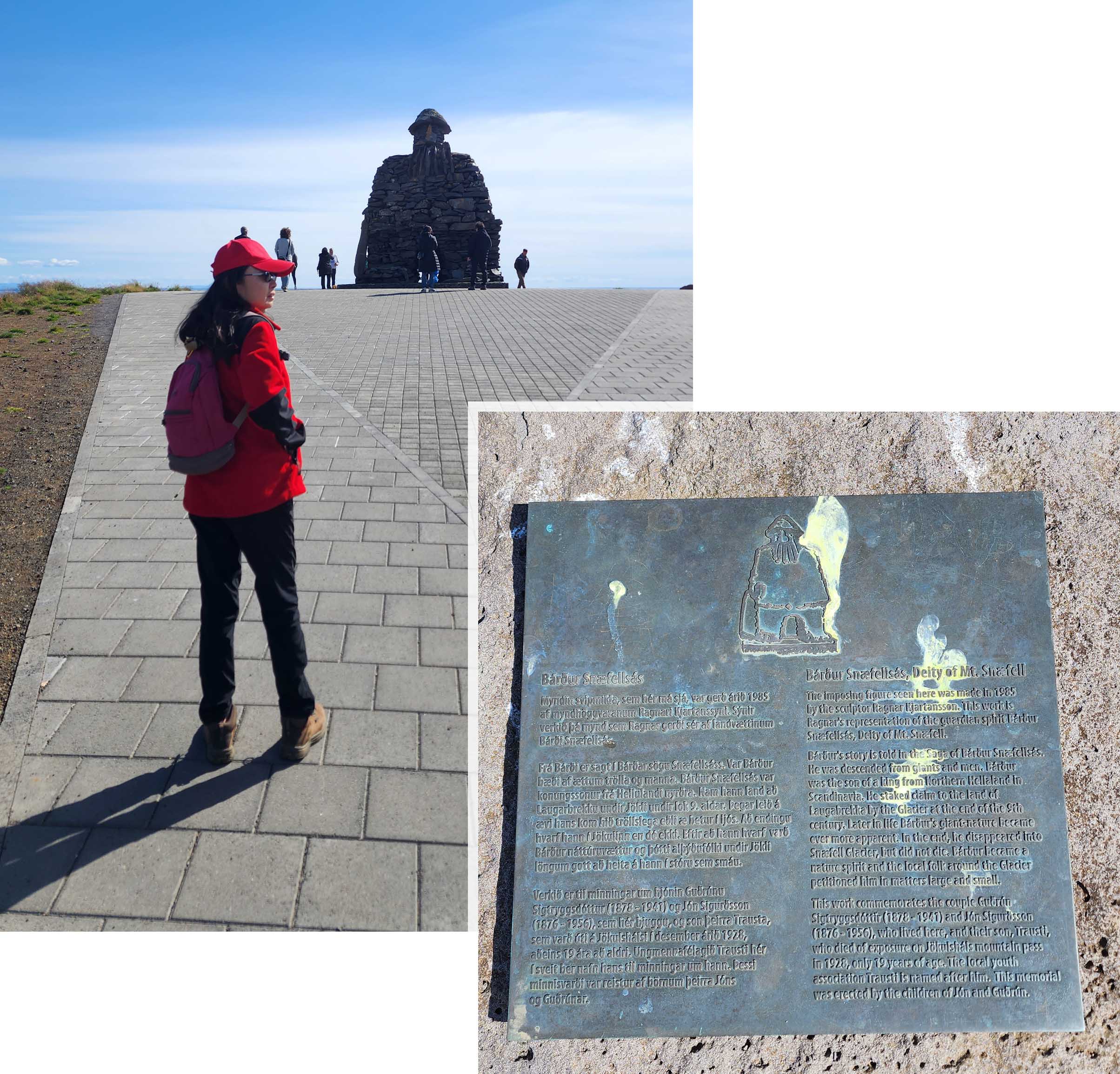
Bárður Snæfellsás Statue was made up of many piece of stones stacked up. Bárður Snæfellsása also known as the protector of Snæfellsás was a giant, a troll, a titian mix who once lived with his family on this peninsula. There was a long “history” (definitely a myth) of events which ended with him (Bardur) retiring into Snæfellsjökull glacier, where he built a large cave for himself to stay in isolation. He would only come out of the cave when people called upon him for help.
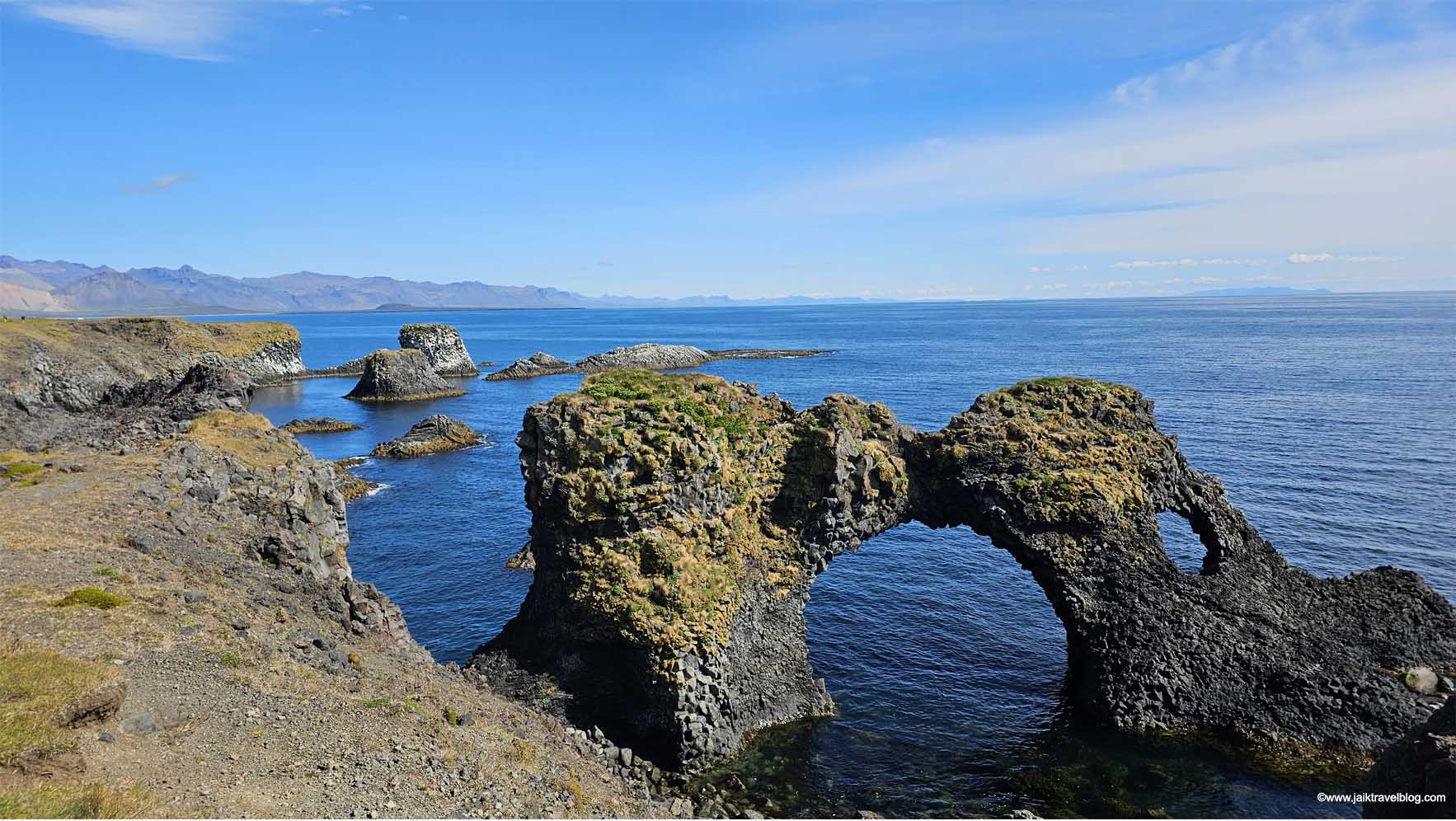
From the carpark we walked to Arnarstapi Cliff Viewpoint which looked stunning under the bright day light. From there we walk a short distance and saw Gatklettur Arch a “ribbon” or a “bow tie” looking rock formation. The arch looked so rugged and it filled us with the sensation of violent sea waves trashing it through the centuries to create this “ugly” looking rock formation.
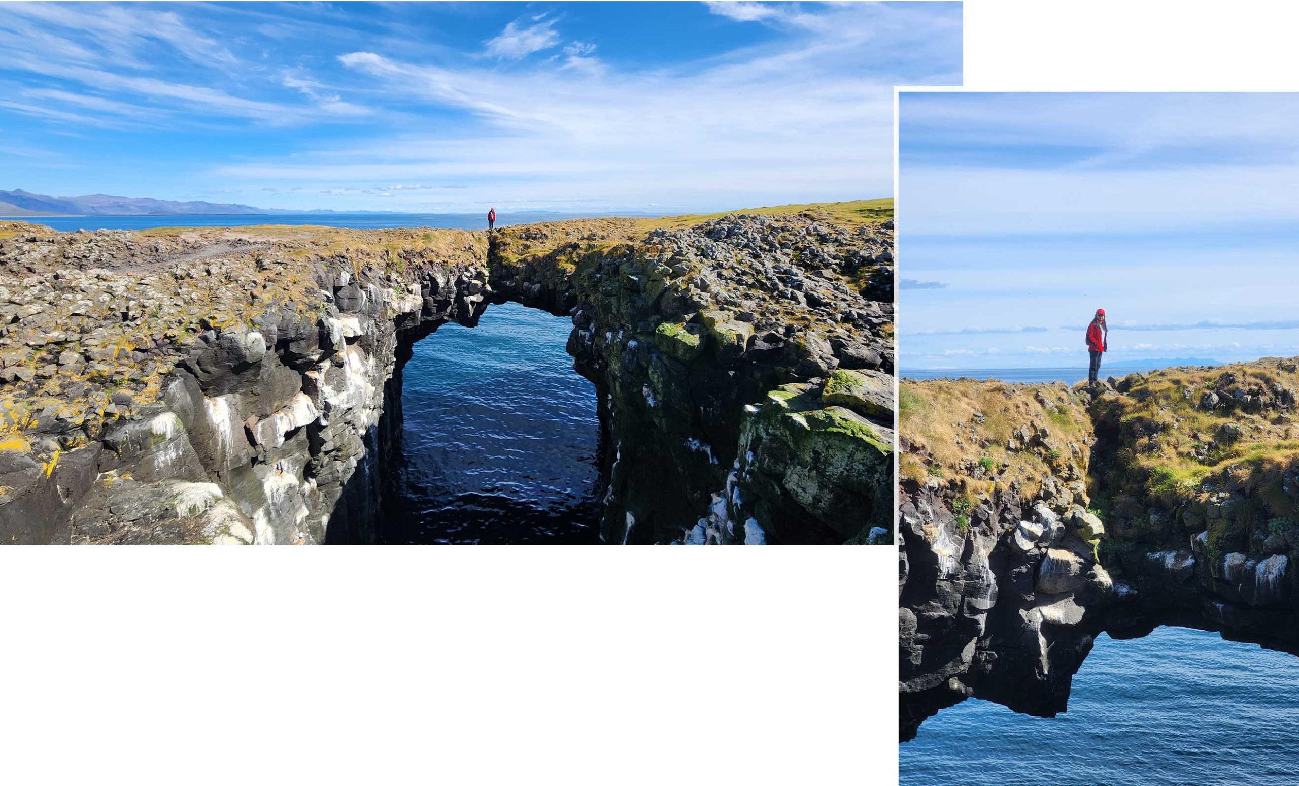
After Gatkelettur Arch we walked in search of Músagjá a stone bridge. For a while we could not find it until we realised that we have been walking over it several times. It was just that the top of the bridge was so huge that we did not realise that there was a channel beneath. We could only see that it was a bridge when we viewed it from the other (inland) side.
From Arnartstapi we drove about 8.8 km to Longrangar. We drove on a road named “Útnesvegur” and turned left into a branch that said “Svalþúfa og Þúfubjarg”. Almost immediately was a carpark. After parking it was a short walk to the Longrangar View Point. The viewpoint was on the top of a high cliff and from there we saw Longrangar at a distance.
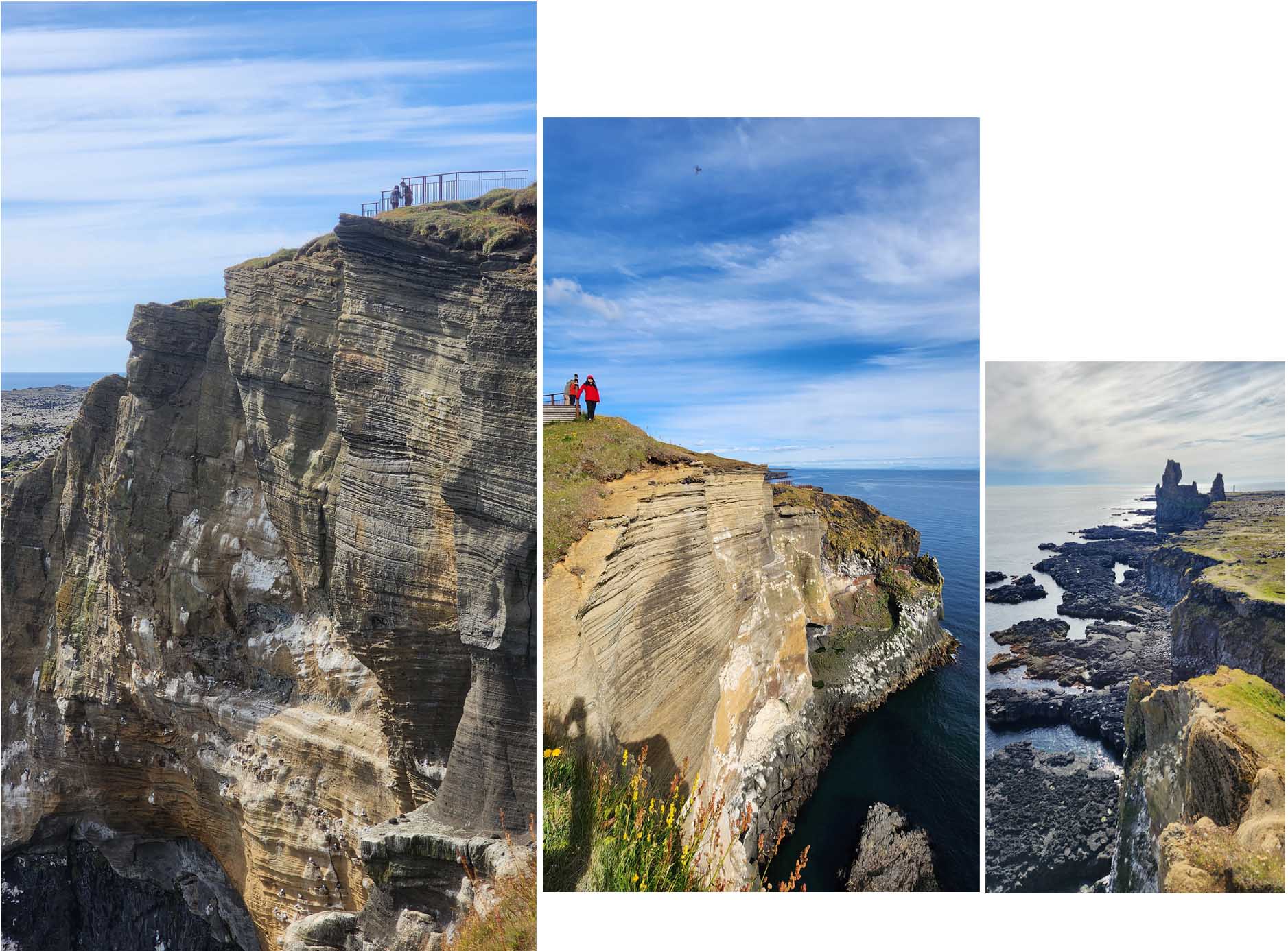
There wasn’t as many people here as compared to Arnartstapi. It was hard to imagine that Longrangar was once a volcanic crater. All that remained after centuries of ocean battering were two “tower” looking pillars (75 metres and 61 metres high), left standing proudly facing the sea.
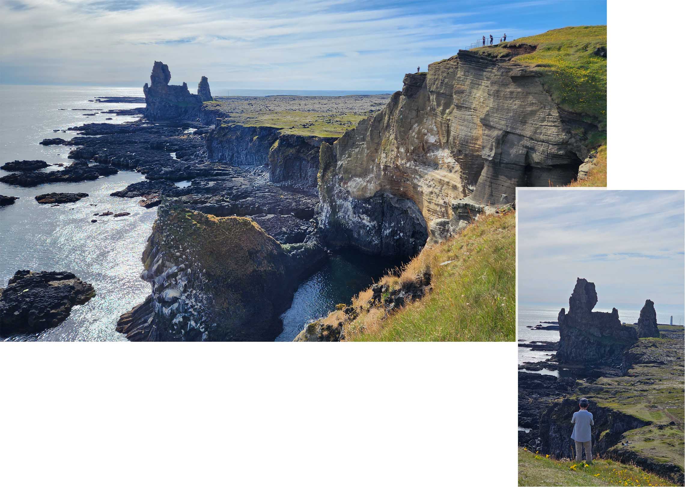
From the view point we did not see a visible path leading right to Longranger. We were also not very keen to go up close as Longranger looked magnificent from far!
Svöðufoss
Svöðufoss was on the west and top side of the peninsula. From our stay to Svöðufoss parking was a 34min drive, parking was free. From the carpark to the falls was a big green field and there was a ” metal grate” boardwalk that lead to the falls.

The boadrwalk made a big curve through the green field and as we walked on we were “bombarded” by gushes of cold wind. There was no where to hide we just had to “plow” forward.

From far we could already see Svöðufos and it looked stunning with the majestic Snæfellsjökul towering behind it. We supposed the source of the water must come from the icy mountain behind.
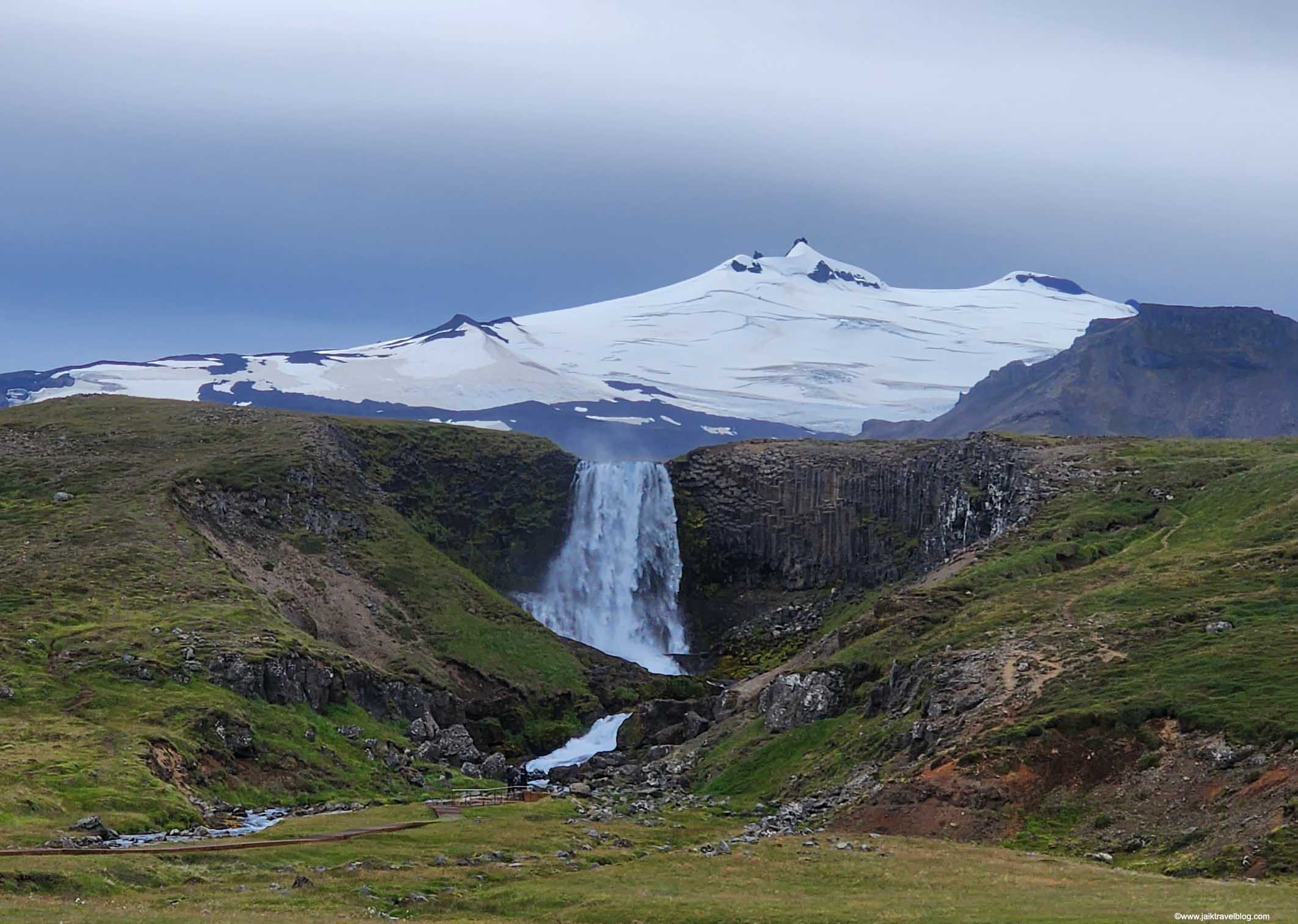
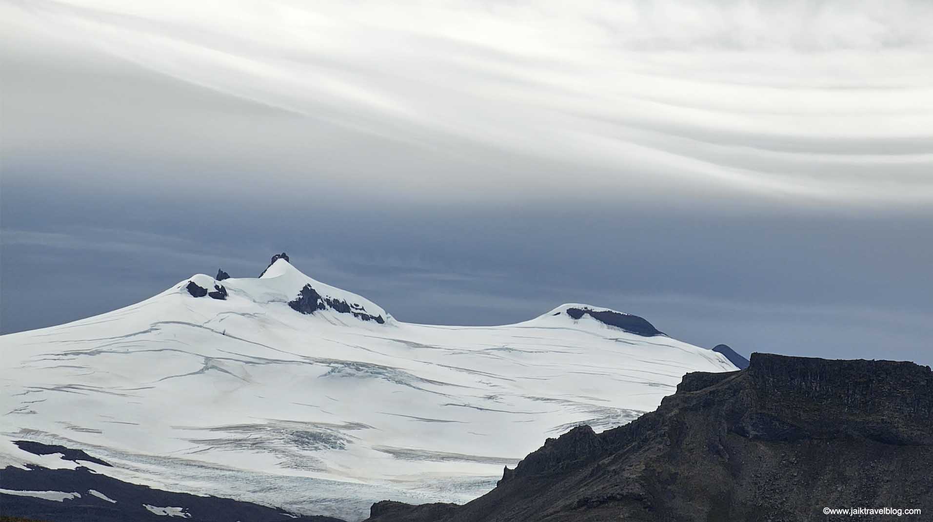
Snæfellsjökull was a active volcano, its last eruption occured 1800 years ago. This glacier-capped volcano was found on the tip of Snæfellsnes Peninsula. The volcano was about 8 or 9 km from Svöðufoss but due to its size, it looked practically “seated” directly behind Svöðufos.
As the nearer we walked to the falls, the lower Snæfellsjökull sank from our view until we could not see it at all. The board walk came to an end still some distance from the base of the falls. There were warning sign not to go beyond the boardwalk so we did not proceed further.
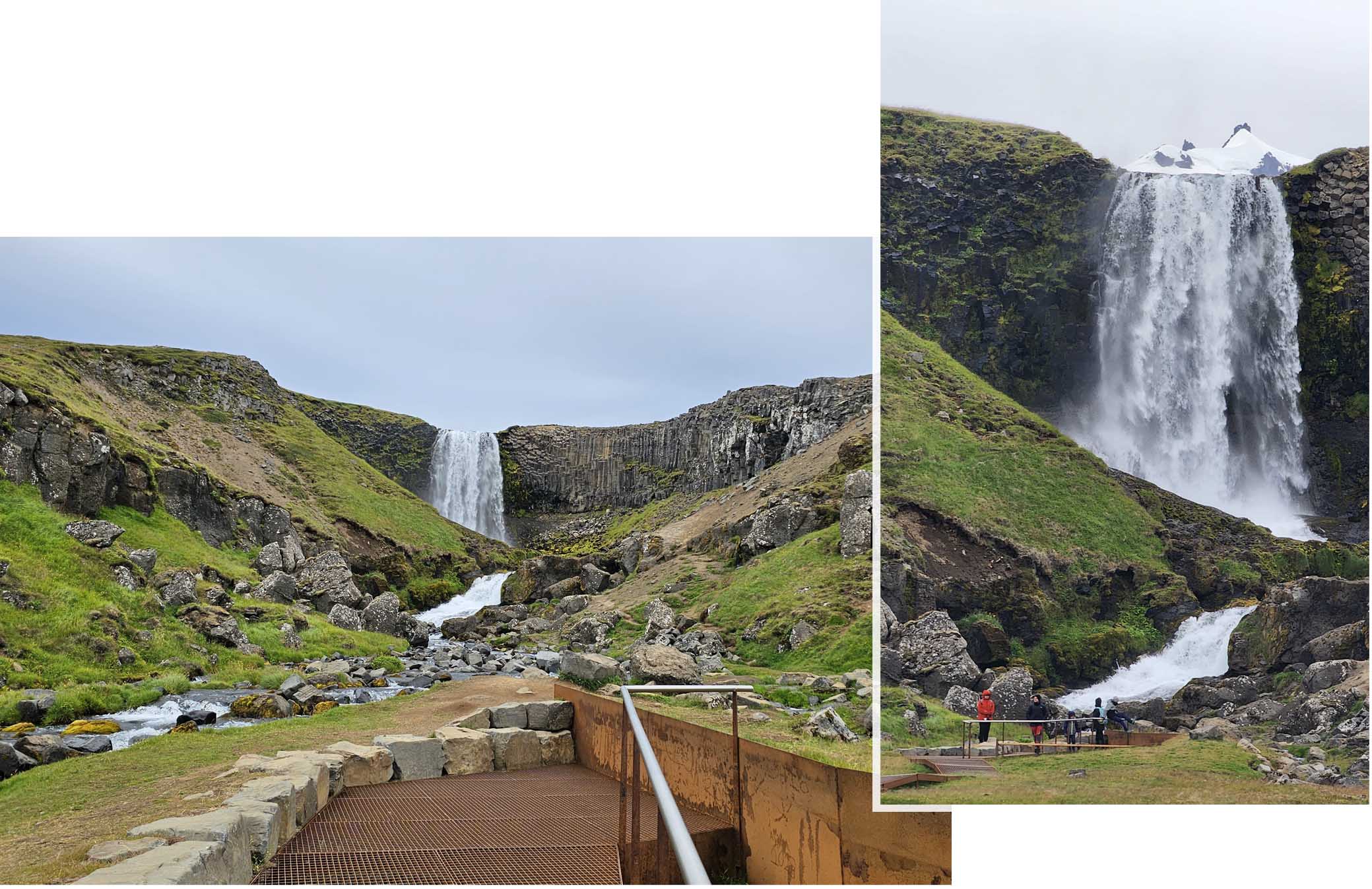
Svöðufoss was 10 meters high, but to us it definitely looked higher than 10 meters. Its water fell off a basalt columns cliff. At a near the distance the falls did not look as impressive as Snæfellsjökull, the glacier mountain was totally out of sight.
Skarðsvík Beach & Olarfviks
After we were done with Svöðufoss we drove westward towards a place which was stated on google map as Snæfellsjökull National Park. This national park was was established in 2001, and it covered about 170 km2 of the westmost tip of the Snæfellsnes peninsula.

We did not see anything impressive so we drove on till Skarðsvík Beach where we stopped, parked and came down to explore. The beach was pretty normal, we took a couple of “shots” and decided not to proceed on the lighthouse further in.

Rather than to continue our drive forward which would go “round” the tip of the peninsula to eventually reached Longranger Cliff /Arbarstapi which we had visited the day before, we decided to back track to Olafsvik town to have a coffeee break.
Olafsvik was a fishing town of just over a 1000 people, located on the west side of the Snaefellsnes peninsula. It had a beautiful church with a “rainbow” road leading to its door step.

This church was built in 1967 and unlike a traditional church looking structure, it was a modern grey and white structure. The architectural theme was certainly “triangle”. The church looked close so we did not attempt to go in.
Down the same road of the church was a cafe and that was where we wanted to enter.

Our Stay
Our stay was a large studio at Helgrindur guesthouse, it costed Eur760 for four nights (no breakfast). The room though large had a pretty weird layout. The kitchenette was far away from the dining table with a toilet in between. So cooking our meals meant a great deal of moving about in the room as the kitchenette table top did not have enough space to work on.

The comfy sofa was by the kitchennette which did not serve much purpose and it was so far away from the TV which was directly above dining table. So there was no way to laze about comfortably to enjoy some Netflix movies at the end of the day.

Our stay at Helgrindur guesthouse was at a good location as very near to Kirkjufell and Kirkjufellsfossar. During these four days we stopped by Kirkjufell and Kirkjufellsfossar many times to view them from different angles and timing of the days.

The kitchenette was pretty insufficient for cooking but we still managed. There were only a microwave, a small fridge, a toaster and a coffee maker. A microwave was only good enough for heating up stuff,
Luckily we did bring along a portable electric cooking pot which allowed us to cook hard boiled egg and pasta. In the future we really had to scrutinise the kitchen items in the hotel listing especially for places that we planned to stay over a few nights!

Our meals during our four days at Helgrindur Guesthouse